
Growing up in Arkansas, I was surrounded by some of its best landscapes: towering bluffs, winding rivers, and deep caves. I saw so much of it, I started to take it for granted.
And while Arkansas doesn’t have the tallest mountains, it makes up for it with variety. You can hike to waterfalls, caves, cliffs, and sweeping views — sometimes all in one afternoon.
But while most people stick to the well-known trails, the best hikes in the state are off the beaten path, tucked away in remote corners of the Ozarks and Ouachitas.
In this guide, I’m sharing my top hikes in Arkansas, so you can find your own favorite trail (or three).


8 Best Hikes in Arkansas
Seven Hollows Trail
The Seven Hollows Trail isn’t your typical Arkansas hike. It doesn’t build up to one big payoff like a sweeping overlook or roaring waterfall.
Instead, the trail is the payoff.
From start to finish, it winds through some of the most interesting natural features in Arkansas: rocky caves, stone bluffs, natural arches, and a tucked-away grotto with a seasonal waterfall.
The trail gets its name from its small valleys or ‘hollows’ carved out by creeks over millions of years. These hollows give the trail its unique topography and make it one of the most interesting hikes in the state.
One of the trail’s signature features is its natural stone arch. It’s a massive, curved rock formation that looks like a bridge.
The archway is located just off the side of the trail and is impossible to miss. You can walk beneath it and take in the scale of the stonework shaped entirely by time and erosion. It’s easily one of the most unique landscapes in Arkansas.
Read my full hiking guide: Seven Hollows Trail in Petit Jean Arkansas


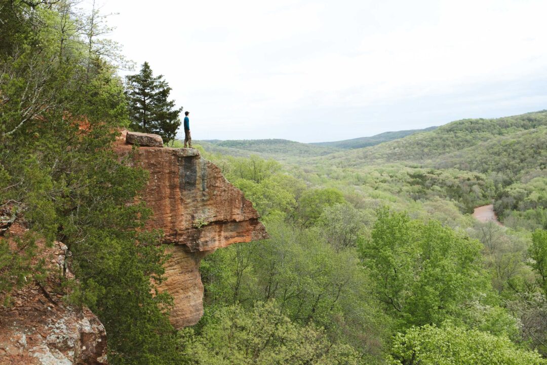
Whitaker Point Trail (Hawksbill Crag)
Whitaker Point is one of the most photographed spots in Arkansas. It’s that iconic rock ledge jutting out over a sweeping valley in the heart of the Ozark Mountains.
But what most people don’t realize is that the trail to this famous overlook has more to offer than just its rocky viewpoint.
All along the cliffside, there are other rocky outcroppings where the view is just as good as the famous Whitaker Point.
And better yet, along the way, there is a short side trail to a waterfall cascading over a limestone cave. You can really see the best of Arkansas in this one hike.
This hike is popular, especially on weekends when the weather is nice. We visited on a Saturday and had no issue finding a place to park, but I would try to get there as early as you can.
Read my full hiking guide: Whitaker Point Trail (Hawksbill Crag)


Glory Hole Waterfall Trail
The Glory Hole Waterfall Trail leads to a natural wonder where a creek has carved a perfect circle through a limestone slab, sending water plunging through the rock and into a cavern-like space beneath.
It’s the most unique waterfall I’ve ever seen.
The trail to the Glory Hole Waterfall is doable by most people. It’s a good hike for kids since it’s not too long and has a unique waterfall at the end that they won’t ever forget.
Once you get to the Glory Hole Waterfall, you can view it from above, where the water disappears into the stone, and from below, where it drops into a cave-like grotto.
I recommend doing this hike after a good rain. The creek that feeds the Glory Hole Waterfall is not big and is known to dry up to a trickle if it hasn’t been raining.
Just past the Glory Hole Waterfall is a massive bluff, which I also recommend exploring. There is a primitive trail along the bluff, and if it’s been raining, tiny water droplets flow over the bluff, creating a beautiful atmosphere.
Read my full hiking guide: Glory Hole Waterfall Trail in Arkansas


Centerpoint to Big Bluff Goat Trail
Big Bluff is one of the crown jewels of the Buffalo National River. It’s the tallest sheer bluff face along the entire Buffalo River, towering 550 feet above the water.
What’s even crazier is that there’s a trail that goes right through the bluff itself. The Goat Trail skirts the bluff, giving you an unparalleled view of the Buffalo River and a close-up look at limestone formations that make up Big Bluff. It feels unreal when you’re standing on it.
Getting to Big Bluff can be done multiple ways, but the easiest and most straightforward way is by taking the Centerpoint Trail, then walking along the Goat Trail.
The trail is not officially dangerous if you’re careful, but let’s just say you need to watch your step. There are no barriers. It’s just you, the trail, and a straight drop off the bluff into the forest and river below.
But from Big Bluff, the view is mind-blowing. You get a look directly over the Buffalo River snaking through the green Ozark mountains. On a clear day, you can see for miles. Layers and layers of forested mountains rolling away into the distance.
Read my full hiking guide: Centerpoint to Big Bluff Goat Trail


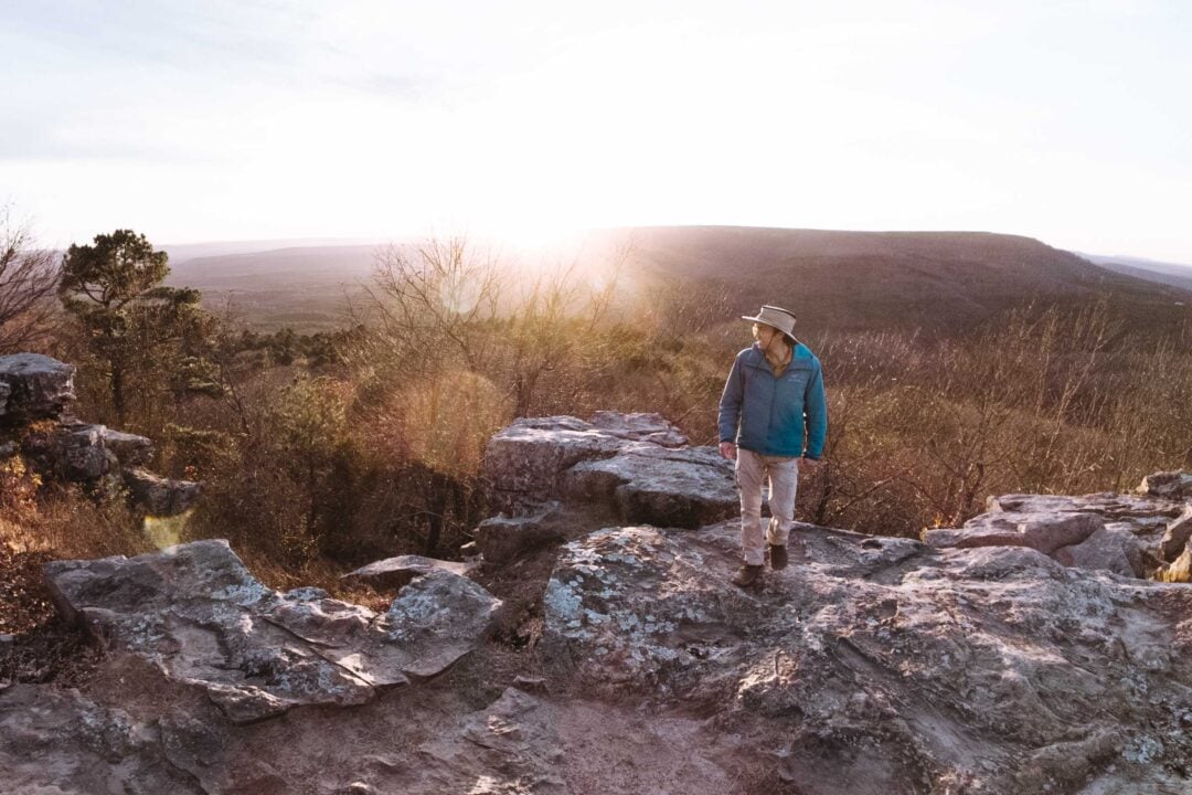
Yellow Rock Trail
Yellow Rock Trail is one of Arkansas’ most famous hikes. It leads to a dramatic overlook perched above Lee Creek Valley in Devil’s Den State Park. Standing on the Yellow Rock provides sweeping views, and it’s often compared to the more famous Whitaker Point.
We had a pretty wild experience hiking the Yellow Rock Trail. Our hike was wedged perfectly between two storms.
The gorge near the start of the trail had turned into a small stream, with water running directly down the path. On one side, a temporary waterfall was pouring off the rock wall.
But even in the overcast light and rain-soaked stone, the Yellow Rock’s iconic triangular shape was unmistakable. Except this time it wasn’t so yellow. It was more orange. Probably because of the rain.
Read my full hiking guide: Yellow Rock Trail in Devil’s Den, Arkansas


Winding Stairs (Little Missouri Trail)
The hike to the Winding Stairs is an adventure into the Arkansas backcountry, with river crossings and plenty of solitude. It’s great for both day hiking and backpacking, although it’s located out in the middle of nowhere.
But the hike’s destination has some of the best landscapes in the Ouachita Mountains. Along the Little Missouri River, layered rock shelves create the “winding stairs”. The scenery here is some of the most dramatic in the Ouachitas, and it left me with that rare feeling of truly being off the grid.
The “stairs” are the natural rock formations that step down along the riverbed, flanked by bluffs and massive boulders.
There’s no single viewpoint or destination marker. This area is more of a zone you explore on your own. Hike, scramble, or just find a quiet spot along the water to take it all in.
Read my full hiking guide: Winding Stairs in Arkansas


Cedar Falls Trail
The Cedar Falls Trail is one of Arkansas’ classic hikes. It drops down through the forest, winds along a rocky path, crosses a creek, and ends at one of the most picturesque waterfalls in the entire state. It’s a rugged, two-mile round-trip trail that goes down into Cedar Canyon and ends at the base of the 95-foot Cedar Falls.
But what most people don’t realize is that Cedar Falls isn’t just a photo stop.
You can explore around the pool, go for a swim, or even carefully make your way behind the waterfall when conditions allow. The falls can be a powerful roar or a gentle flow of water, depending on recent rainfall.
As the trail descends into the canyon, the habitat shifts from dry upland forest to wetter, lush greenery on the canyon floor. The trail levels out and runs alongside Cedar Creek and goes upstream toward the waterfall.
Read my full hiking guide: Cedar Falls Trail in Arkansas


Hemmed-In Hollow Falls
At 209 feet, Hemmed-In Hollow Falls is the tallest waterfall in Arkansas, and also the tallest waterfall between the Rockies and the Appalachians.
But catching it at full flow takes some timing. Most of the year, the falls are little more than a trickle, sometimes even bone dry.
After a good rain, though, the water returns, and it’s absolutely worth the wait.
When it’s flowing, the water doesn’t just fall… it dances.
Wind swirls through the canyon, sending the stream drifting side to side, breaking it into a spray of mist and droplets. It’s a surreal scene, especially when you stand at the base and look straight up.
There are two ways to get to Hemmed-In Hollow Falls.
One is a tough hike from the Hemmed-In Hollow trailhead in Compton.
Your other option is to float the Buffalo River and hike in from the shore. That’s how I did it, and it made for a short, scenic walk to one of the most jaw-dropping waterfalls in Arkansas.


Looking for more things to do in Arkansas?
I grew up spending my summers in Arkansas and have been all over the state. To help fellow adventurers, I’ve put together guides to the best places I found. You can check them out by clicking the links below.
- My ultimate Arkansas hiking guide: 8 Incredible Hikes in Arkansas: Complete Travel Guide
- Best canoe/kayak adventure in Arkansas: How to Float the Buffalo River
- My favorite hike in Arkansas: Seven Hollows Trail
- Best waterfall hike in Arkansas: Cedar Falls Trail
- Most dangerous hike in Arkansas: Centerpoint to Big Bluff Goat Trail
I hope you enjoyed my guide to the best hikes in Arkansas. Feel free to leave a comment below if you have any questions 🐸


Wonderful job Trey,
Your trip information has been helpful for me as I plan some adventures in Arkansas, but live in Texas.
Thank you Greg