Hiking the Burroughs in Mount Rainier National Park is a day of extremes. One moment, you’re baking under the unshaded sun. The next, you’re walking slowly up a snowfield that refuses to melt. The wind whips hard, kicking dry dust up in your face.
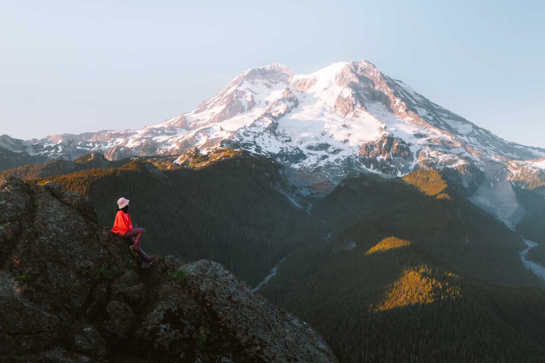
But even in a climate that seems too harsh for anything to endure, life finds a way. Wildflowers bloom in late summer. Goats, marmots, and chipmunks wander around the rocky landscapes. And then there’s Mount Rainier itself, looming over the Burroughs unobstructed. It’s one of the closest views you can get of the mountain on a hike.
In this guide, I’ll share everything you need to know before hiking the Burroughs in Mount Rainier National Park, including how to get there, what to expect on the trail, and tips from our own experience to help you make the most of your hike to this rugged alpine landscape in the Sunrise area of Mount Rainier.


Burroughs Mountain Trail Complete Guide
The Burroughs is one of the best hikes in Mount Rainier National Park. The trail goes through a rocky, tundra-like landscape that gets you up and close to Rainier’s summit, providing you with views of the Emmons and Winthrop glaciers. It’s a well-marked, hard hike with around 2,500 feet of elevation gain over 9 miles round-trip.
The hike begins in the Sunrise area of Mount Rainier National Park, the highest point you can drive to in the park.
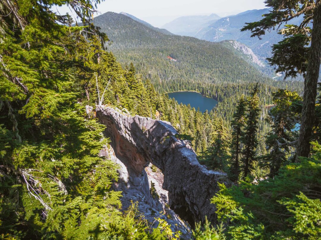
From the Sunrise visitor area, take the Sunrise Rim Trail 1.4 miles toward Sunrise Campground. That is where the Burroughs Mountain Trail starts. There’s a toilet at the campground, and it’s worth using it there because once you’re on the trail, you’ll find almost no trees or cover for the rest of the hike.

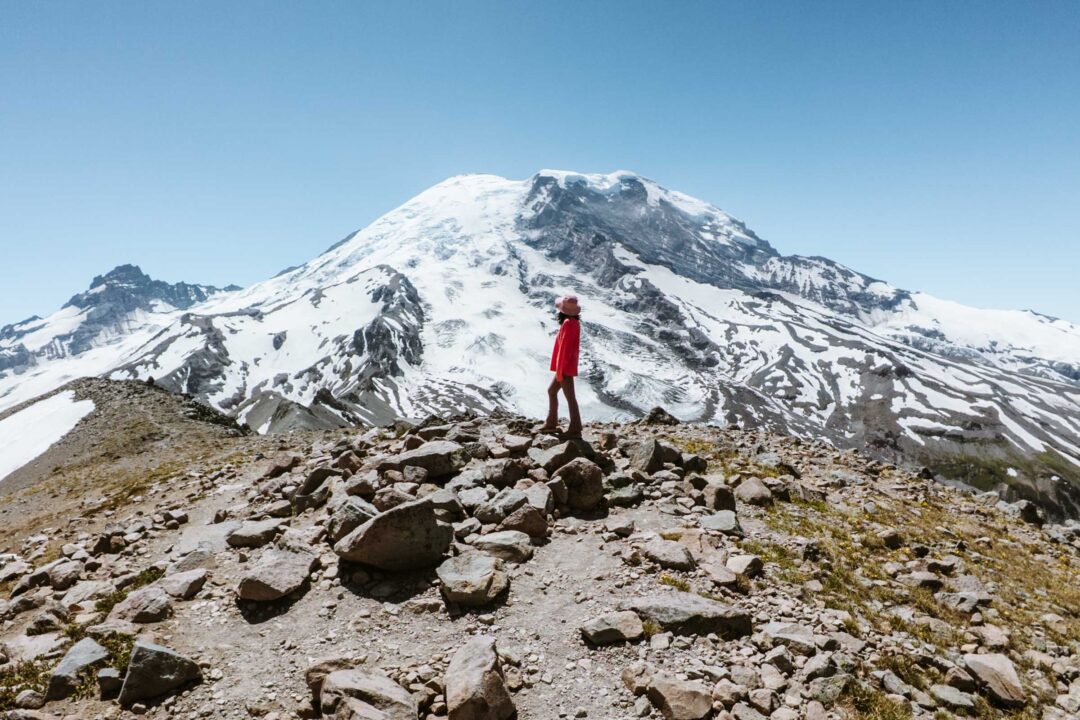
From Sunrise Campground, the trail climbs slowly up the First Burroughs, passing the Glacier Overlook after about 0.3 miles. Stop there for a view of Mount Rainier and the Emmons Glacier.

The First Burroughs isn’t a dramatic summit, and you may not even realize you’ve reached it until the trail levels out and you see the trail intersection. At the trail junction, stay left to continue to the Second Burroughs.

The Second Burroughs is only 0.6 miles further. You’ll know you’re there when you find a stone seating area shaped like a tortoise shell. It’s a perfect seat for lunch with a view of Mount Rainier.

The trail between the Second and Third Burroughs is the toughest part of the hike. You start by losing a significant amount of elevation as the trail drops into a valley, only to climb back up on the other side. The climb is slowed even more by lingering snowfields, which can persist into summer.


Hiking poles are a necessity for getting across the snow fields, and microspikes are worth bringing if you have them. Take your time crossing snow fields because they are slick and steep.
As you approach the Third Burroughs, you’ll have a unique view of Little Tahoma. The jagged spire juts out of the landscape like its own mountain.

Reaching the summit of the Third Burroughs certainly feels like an accomplishment. It’s one of the closest points you can hike to Mount Rainier, yet the summit is still four miles away.

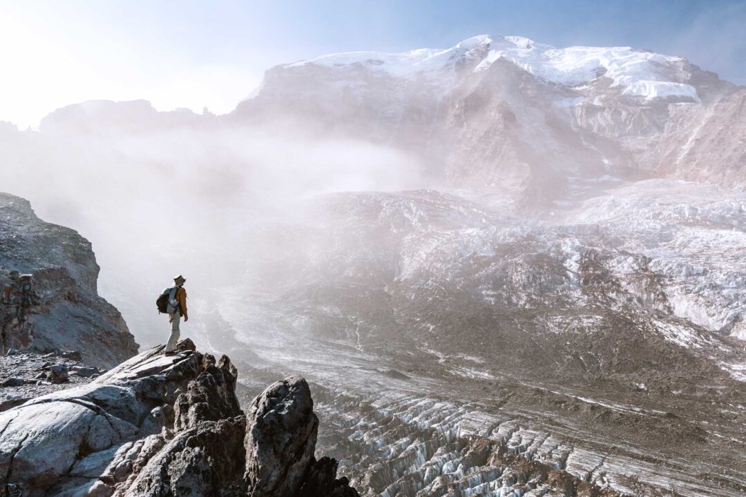
Below you, the Winthrop Glacier stretches out, its crevasses and meltwater channels a reminder of its retreat. To the north, the pyramid shape of Skyscraper Mountain stands out, and on a clear day you can even spot Glacier Peak and Mount Baker on the distant horizon.


Burroughs Mountain Hike Details
- Hike Distance: The total distance of the hike is about 9 miles round-trip to the First, Second, and Third Burroughs and back.
- Hike Duration: The hike takes approximately 8 hours in total, including time spent enjoying the views.
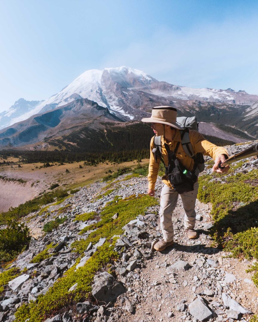
- Hike Difficulty: The trail’s difficulty is hard. The hike is a long distance with no shade. The terrain is not very technical, but it is the kind of trail that just keeps going and going, especially if you hike all the way to the Third Burroughs. Bring plenty of water because there is nowhere to fill your bottle once you get up into the Burroughs.
- Hike Incline: The total incline for this hike is about 2500 feet.
- Dogs are NOT allowed on this trail because it is located in Mount Rainier National Park.
- A Mount Rainier Entrance Pass is required to hike The Burroughs. The trail entrance for The Burroughs is located in the Sunrise area of Mount Rainier National Park and also requires a Sunrise Timed Entry reservation ahead of time.

How to get to the Burroughs Mountain Hike Trailhead
The Burroughs Mountain trailhead is located in the Sunrise area of Mount Rainier National Park.
If you want to hike the Burroughs, you will need a Sunrise Timed Entry reservation during the peak summer season. These permits are required for day-use access and can be booked in advance starting in May through the Recreation.gov website. If you miss the initial release, a limited batch of additional tickets becomes available the day before your visit at 7 PM.
The trail route for the Burroughs Mountain Loop below is accurate and can be used to navigate the trail.
We followed the route that goes through the Sunrise Camp, but you can also take the northern route that goes by the Frozen Lake. Or you can do both and make it a loop. The choice is yours.
Use the map below to navigate to the start of the Burroughs Mountain trail in the Sunrise parking area of Mount Rainier National Park.

Burroughs Mountain Hike in Mount Rainier: Our Experience
We hiked the Burroughs as part of our exploration of the Sunrise area of Mount Rainier. The night before, we camped at Sunrise Campground, which put us right at the trailhead the next morning. After a quick breakfast, we packed up our day pack and set out toward the First Burroughs.

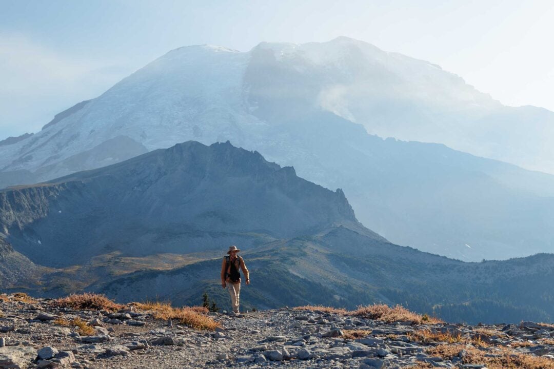
The trail climbed steadily at first, and we stopped at the Glacier Overlook for our first view of Mount Rainier for the day. After we left the overlook, the trees grew shorter and shorter. And by the time we made it to the top of the First Burroughs, they disappeared entirely. Losing our only shade for the day wasn’t encouraging, but we were fully committed to hiking to the Third Burroughs, even under direct sun.

Our approach to the Second Burroughs was where we reached our first challenge: patches of lingering snow. We paused at each one to assess whether it was safe to cross.
The snow patches were melting out quickly, and we started our traverse by following in the footsteps of hikers before us. We took our time, using our hiking poles to stabilize us as we made our way up. It definitely took some care to hike uphill in the snow, and I had to kick in the snow to carve out little steps of my own as I ascended.

After the second snowfield, the trail leveled out as we reached the top of the Second Burroughs. The area was marked by a bench shaped like a tortoise shell made out of stones.

The view of Rainier was even closer at this point, but the view of the trail to the Third Burroughs was more daunting. The trail dropped into a valley before turning back up toward the Third Burroughs. And of course, more snowfields waiting for us on the trail. I knew it would be tough, but I still underestimated how long it would take to hike there.
We began our descent into the open, barren valley as the midday sun baked down on us. I spotted tiny hikers far across the valley, some nearly a mile away.

The snowbanks did not get easier on our way to the Third Burroughs. They were steeper, longer, and less traversed than the earlier ones. We took extra caution crossing them, moving slowly as we hiked up the slick snow.


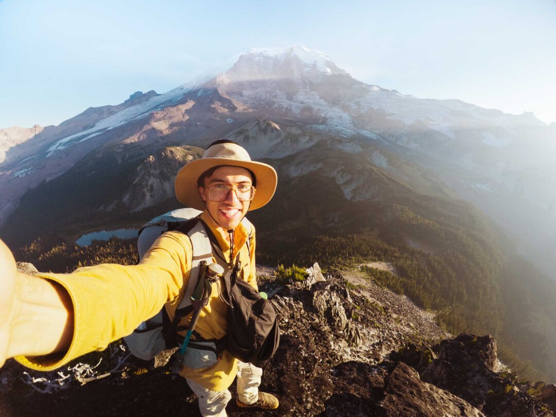
We alternated between snowfield and rocky, dusty, dry landscape before finally making it to the top of the Third Burroughs.
We walked over to the high point, which revealed a view of the north: Skyscraper Mountain looming before us, with Mount Baker, Glacier Peak, and the Central Cascades in the distant background.

As we hiked across the top, we met a solo hiker sitting on a rock, taking in the view. We started chatting with him, and he took the time to tell us about the landmarks surrounding us: the Winthrop Glacier below, Little Tahoma jutting out on the side, and Steamboat Prow guarding the route to the summit of Rainier.
It became obvious that he was a Mount Rainier veteran when he pulled out an old, worn-out map of the area and traced out some of the more distant areas, such as Goat Island and Summerland across the valley.

Our hike back down the trail was much quicker than the hike up. But it was still a slog in the afternoon heat. We stopped at the Sunrise Camp to pick up our backpacking packs before making our way back to the trailhead, stoked about the adventure we just had.
Burroughs Mountain Hike Photos


I hope you enjoyed our guide to the Burroughs Mountain hike in Mount Rainier National Park. Feel free to leave a comment below if you have any questions 🐸

Loved this fun and challenging hike! 🙂