Most waterfall hikes follow the same formula: forest trail, followed by a cascade, and maybe a scenic overlook.
But few trails end at a waterfall that drops straight through a hole in solid rock into a cave below. That’s exactly what makes the Glory Hole Waterfall in Arkansas so special.
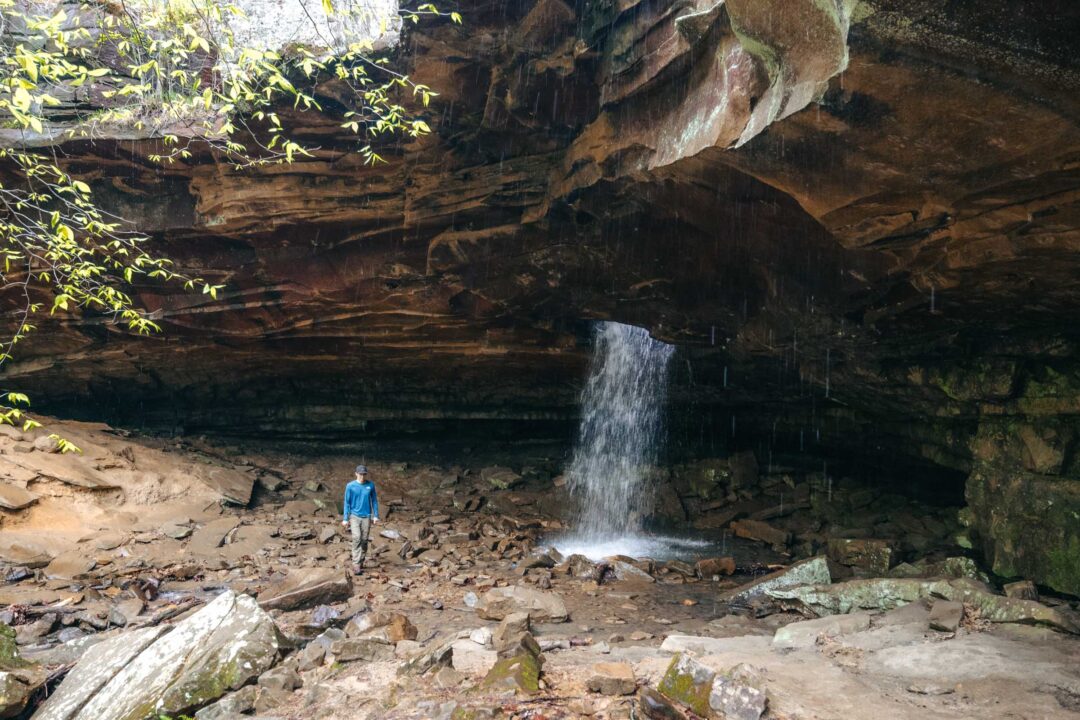
The Glory Hole Waterfall Trail leads to a natural wonder where a creek has carved a perfect circle through a limestone slab, sending water plunging through the rock and into a cavern-like space beneath. It’s the most unique waterfall I’ve ever seen.
But getting to the Glory Hole Waterfall is a bit confusing since it’s not an official trail. There isn’t much reliable information out there.
In this guide, I’ll share everything you need to know about hiking to the Glory Hole Waterfall, including how to find the trailhead, what the hike is like, and tips from my own experience to help you make the most of your trip to this unique Arkansas waterfall.


Glory Hole Waterfall Trail Complete Guide
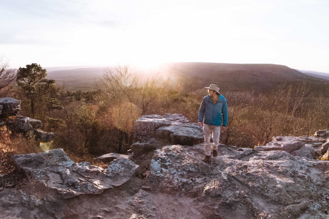
The hike to Glory Hole Waterfall starts on an old ATV road. It’s a wide, easy-to-follow path that gradually heads downhill through the woods until it meets up with a creek. From there, the trail loosely follows the creek as it continues downhill until it reaches the Glory Hole Waterfall.
The trail itself is doable by most people. It’s a good hike for kids since it’s not too long and has a unique waterfall at the end that they won’t ever forget.
Once you get to the Glory Hole Waterfall, you can view it from above, where the water disappears into the stone, and from below, where it drops into a cave-like grotto.
I recommend doing this hike after a good rain. The creek that feeds the Glory Hole Waterfall is not big and is known to dry up to a trickle if it hasn’t been raining.
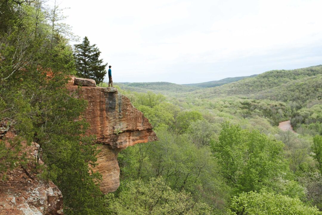
Just past the Glory Hole Waterfall is a massive bluff, which I also recommend exploring. There is a primitive trail along the bluff, and if it’s been raining, tiny water droplets flow over the bluff, creating a beautiful atmosphere.


Glory Hole Waterfall Hike Details
- Hike Distance: The total distance of the hike is about 2 miles. 1 mile out + 1 mile back.
- Hike Duration: The hike took us about 1.5 hours total, including time spent sightseeing and hanging out at the waterfall.
- Hike Difficulty: The trail is not hard. Going out, it’s all downhill, but the trail is not steep and easily doable. There is one stream crossing, but you don’t need waterproof boots unless it’s been pouring rain. In my opinion the most difficult portion of this trail is the hike back, which is all uphill. Bring at least 1 liter of water, especially if it’s hot out.
- Hike Incline: The total incline for this hike is about 400 feet. On the way out, the hike is all downhill, and on the way back, the hike is all uphill.
- Dogs are allowed on this trail.


How to get to the Glory Hole Waterfall
Glory Hole Waterfall is tucked away in the Ozark National Forest in northern Arkansas, just outside the boundaries of the Buffalo National River. Since it’s not within the national river and the trail isn’t officially maintained, it tends to fly under the radar.
The trailhead is located off Highway 16 in Newton County. There’s no sign marking the trail, but you’ll see a small gravel pull-off on the south side of the highway that serves as the parking area. The entrance to the trail is just off the edge of the parking area.
The map location below for the Glory Hole Falls Trailhead is accurate and can be used to navigate there.

Glory Hole Waterfall Trail: My Experience
We started down the trail, and to be honest, the hike itself isn’t anything spectacular. It’s a wide trail that slopes downhill through the woods. But what was waiting for us at the end made the hike more than worth it.
It was a short walk, passing through the forest and crossing a small creek a couple of times, but otherwise it’s pretty straightforward and quick.


At one point, we stopped, and my dad said he could hear the waterfall. Sure enough, we veered off the trail toward some rocks near the creek and spotted water flowing down into a hole, straight through the rocks. That’s when I got my first glimpse of the Glory Hole Waterfall — from above!
From the top, the glory hole actually looked super dangerous. The surrounding rocks were slippery, so it was hard to step closer to get a clear view.


The trail more or less faded at the top of the glory hole, but we scrambled down a rocky slope to reach the bottom.
Below the hole was a rocky shelf that led into a cave-like space. I stood there and took a moment to look around. It felt like a hidden spot, just tucked away in a little valley with a creek running through it.


The hole was larger than I expected, and because it had rained the day before, the water was gushing down and dispersing over the rocky surface below.
Just past the hole, the creek continued downhill, disappearing off into the forest.
But while most people would turn back at this point, our adventure was just getting started.
Off to the side of the waterfall are some huge rock bluffs, and my dad, being a retired Army infantry officer who never quite lost the urge to explore, decided we should follow the rocks downhill.
At first, it was all good fun. There’s a faint trail running along the bluff, and the massive boulders and jagged shapes made it feel like we’d stepped into another world. It’s the type of thing that makes me appreciate hiking in Arkansas.


But my dad had other plans.
He started scouting for a way up onto the rock face. Eventually, the bluff leveled off a bit, and we found a spot to climb up.
From there, we bushwhacked through the trees along the top of the ridge, completely off trail, pushing through brush and fallen trees. Eventually, we looped back north and reconnected with the main trail, bypassing the creek crossings on the way out, and made it back to the car.


It’s kind of funny because my dad had originally told me he just wanted a quick hike. But once he got out there, he went full explorer mode. I guess that’s the army way.
Anyway, if you’re thinking of going off-trail like we did, download offline maps in advance and use GPS tracking. Cell service is basically nonexistent out there, and it’s easy to get turned around in the woods.

Looking for more things to do in Arkansas?
I grew up spending my summers in Arkansas and have been all over the state. To help fellow adventurers, I’ve put together guides to the best places I found. You can check them out by clicking the links below.
- My ultimate Arkansas hiking guide: 8 Incredible Hikes in Arkansas: Complete Travel Guide
- Best canoe/kayak adventure in Arkansas: How to Float the Buffalo River
- My favorite hike in Arkansas: Seven Hollows Trail
- Best waterfall hike in Arkansas: Cedar Falls Trail
- Most dangerous hike in Arkansas: Centerpoint to Big Bluff Goat Trail
I hope you enjoyed my guide to the Glory Hole Waterfall Hike in Arkansas. Feel free to leave a comment below if you have any questions 🐸