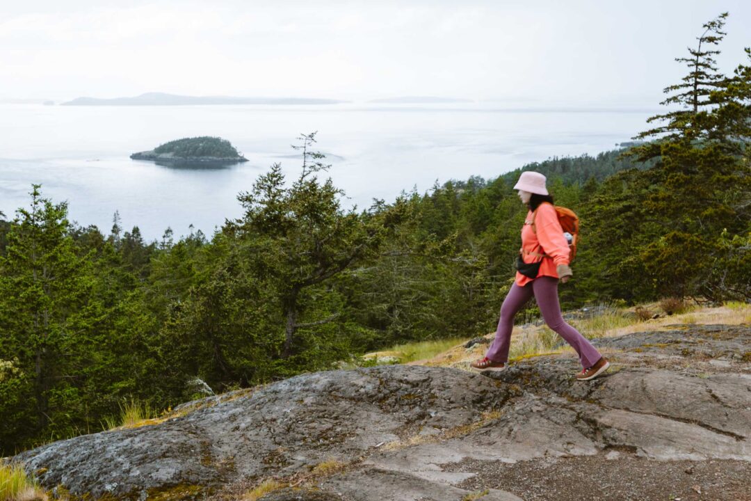
The Goose Rock in Deception Pass is not only the highest point on Whidbey Island, but it also has a unique ecosystem of its own. On its summit are little plants and mosses that have taken hold in its sparse topsoil atop glacier-carved bedrock.
From its summit, you’re rewarded with sweeping views of the Cascade Mountains to the east, the Olympic Mountains in the west, and on a clear day, Mount Baker in the north. It’s a payoff that punches well above the effort it takes to hike the trail.
But there’s more than one way to reach the summit of Goose Rock, and the best route depends on how much time and effort you want to put in.
In this guide, I’ll share everything you need to know before hiking the Goose Rock Trail in Deception Pass State Park, including how to get there, what to expect on the trail, the different route options, and tips from our own experience to help you make the most of your hike to the highest point on Whidbey Island.


Goose Rock Trail: Complete Hiking Guide
There are two main ways to hike the Goose Rock trail:
Option 1: The Goose Rock Perimeter Trail (Loop Route)
The loop starts on the Perimeter Trail and skirts the base of Goose Rock before climbing to the summit via a set of steep switchbacks. That’s the route we took. And honestly, I don’t recommend it. It makes for a longer hike, the views along the perimeter are underwhelming, and you lose a lot of elevation only to regain it later. This loop is about 2.2 miles total.

Option 2: Goose Rock Summit Trail (Out-and-Back)
If you want the best views for the least effort, skip the perimeter loop and hike directly up the Goose Rock Summit Trail. It’s more straightforward, less strenuous, and leads you straight to the panoramic views at the top of Goose Rock. This route is about 1 mile total out and back.

Want a Longer Hike? Start at the North Beach Trail
If you’re looking to get a longer hike in, I recommend hiking the North Beach Trail starting at West Point, then linking up with the Goose Rock Trail at Deception Pass. This is what I recommend.
This route adds some variety by hiking through a coastal rainforest along the beach with views of the famous Deception Pass bridge along the way.
If you hike North Beach to Goose Rock Summit, then the hike is about 3 miles total out and back.

Goose Rock Trail Hike Details
- Hike Difficulty: The Goose Rock trail difficulty is easy/moderate. The perimeter trail is in great shape and easy to follow, but it has some steep rocky areas of incline going up to the summit. If you hike directly to the summit from the trailhead, there is much less incline, and the trail is firmly in easy territory.
- Hike Incline: The total incline for this hike is about 550 feet. If you hike directly to the summit, there is less up and down, so the incline is a bit less, around 400 feet.
- Dogs are allowed on this trail, but must be on a leash.
- A Washington State Discover Pass is required to park at the trailhead the Goose Rock Trail.

How to get to the Goose Rock trailhead
The trailhead for the Goose Rock Trail is located in Deception Pass State Park on Whidbey Island. The start of the trail is directly at the south end of the Deception Pass Bridge.
The trailhead has a parking area and a toilet, and you need a Washington Discover Pass to park there.
The map location below for the Goose Rock trailhead is accurate and can be used to navigate there.
Goose Rock Trail at Deception Pass: Our Experience
We started our hike at West Point in Deception Pass State Park. We took the North Beach Trail along the water before connecting to the Goose Rock Perimeter Trail and eventually reaching the summit.
The first stretch along the North Beach Trail was surprisingly beautiful. I’m not usually a big fan of Washington beaches, but this trail ran just off the shoreline, tucked inside a coastal rainforest. It was neat to be walking right at the same elevation as the beach while surrounded by mosses and towering trees.


Every so often, we poked our heads out of the forest to take a quick look at the beach to check our progress as we made our way toward the Deception Pass Bridge. The North Beach Trail was mostly flat, and we could see the bridge slowly growing larger in the distance.

Chloe was wondering how we’d get to the other side of the bridge, and we realized the trail ran directly underneath it. There were staircases on both sides of the bridge where we climbed up and stepped out onto the bridge itself.
I won’t lie, being on that bridge was kind of nerve-wracking. It’s a narrow bridge with fast vehicles moving over it. We didn’t linger for long.


After getting off the bridge, we hopped on the Goose Rock Perimeter Trail. It started off promising. We followed the trail as it skirted the base of Goose Rock.
But the perimeter trail’s novelty wore off fast. Especially when it dropped in elevation, only to go right back up with a series of steep switchbacks. I was sweating halfway up, even though it was chilly outside. Its only saving grace is that it was lined with purple Rhododendron flowers.

But the top of Goose Rock was not much further, and soon the dense forest gave way to an open grassland, and soon we were standing on the top of Goose Rock, the highest point on Whidbey Island.
The first thing we saw when we emerged onto Goose Rock was a wooden fence that guides hikers along a designated path. The ecosystem on top of Goose Rock is fragile, and it has apparently taken thousands of years for its small amount of topsoil to form. Now it supports an eclectic mix of mosses and plants that look a little out of place compared to the type of ecosystems I’m used to seeing in Washington.


We didn’t stay up there for long, because right as we reached the summit, it started raining. We’d been dry all day under the forest canopy, and the second we were fully exposed, the rain started. Just our luck.
But the rain was not a big deal. We descended from Goose Rock along the Summit Trail that goes directly to Deception Pass. After crossing under the bridge again, we retraced our steps through the coastal rainforest.
It was even better to see the moss-covered trees and fallen logs the second time around from a different angle. That kind of beauty never gets old for me.

Goose Rock Trail Hike Photos
North Beach


Deception Pass


Goose Rock


THIS IS AN OUTSTANDING LOOK AT ONE OF MY SPECIAL
PLACES. GROWING UP ON THE ISLAND I MADE MANY
LEAPS TO THE TOP OF THE ROCK STARTING IN 1945.
GLAD IT IS STILL THERE.
AT ONE TIME I WAS GOING TO CROSS THE PASS UNDER
THE BRIDGE; A FEAT THAT A FEW FOOLS HAD DONE.
NOT A VERY SMART MOVE FOR ANYONE TO MAKE.
AFTER A SHORT WAY OUT ON THE GIRDERS I REALIZED
THAT THIS WAS NOT AN INTELLIGENT CAPER.
RETREAT WAS A SMARTER CHOICE..
THERE WAS LATER A TRAGIC TALE. 1950.
A CAR FULL OF US HAD GONE TO THE MAINLAND MOVIE HOUSE AND WERE RETURNING TO WHIDBEY AROUND MIDNIGHT. WE HAD TURNED ONTO THE MAIN
BRIDGE SPAN WHEN A DEER CAME RUNNING TOWARD
US, BOUNCING SIDE RAIL TO RAIL. CONFUSED IN OUR HEADLIGHTS IT TOOK WHAT MUST HAVE SEEMED
AN ESCAPE ROUTE AND JUMPED OVER THE BRIDGE RAIL.
WE PULLED OVER AT THE SOUTH PARKING LOT
AND WHAT HAD BEEN SIX LAUGHING PUNKS WERE
SITTING IN TOTAL SILENCE.
I THOUGHT BACK TO MY ABORTED UNDER BRIDGE
CROSSING. WHAT I HAD JUST WITNESSED PUT A
MORBID AURA ON THE BEAUTY OF THE PASS AND
THE BEAUTIFUL TIMES I HAD AT GOOSE ROCK AND
CORONET BAY.
HOWEVER IT WAS ON THE TRAIL TO THE GOOSE
ROCK APEX THAT I WAS FORTUNATE TO SEE MY FIRST
PILEATED(?) WOOD PECKER. WHITE ALBINO DEER
AND GREAT HORNED OWL. THE NORTH WHIDBEY
WOODS AND BOWMAN’S BAY ARE THICKLY POPULATED
WITH OWL’. ALL SIZES.
I SO DELIGHTED IN YOUR COVERAGE. I HAVE ALL SORTS
OF FOND MEMORIES OF D.P.. CRANBERRY LAKE AND
THE BIG ROCK ON THE ROCK. THE TWO OF YOU
REALLY STIRRED THEM UP. I’LL NOT TROUBLE
RETELLING OF THAT YOUNG GIRL I MET AT SUMMER
CAMP. OR THE TALES OF THE YOUNG PILOTS FROM
NAS WHIDBEY WHO FLEW THEIR TWO SEATER
TRAINING PLANES UNDER THE DP BRIDGE.
YOU MADE THE LAST EIGHTY YEARS OF MY LIFE
SEEM AS ONLY A WEEK AGO TUESDAY.
THANK YOU~ DC