Way out in the wilderness on the north side of Mount Rainier is a trail that ascends straight to a different planet.
It climbs so high that you find yourself looking down on the largest glacier in the lower 48.
It pushes so far that nothing separates you from Rainier’s sheer headwall but air and silence.
Of all the trails I’ve hiked in Mount Rainier, and honestly anywhere, this one ranks among the most elite.
I’m talking about the Curtis Ridge Trail.


Curtis Ridge Trail Complete Hiking Guide
The Curtis Ridge Trail is an unofficial, unmaintained path that traces the edge of Curtis Ridge on Mount Rainier’s northern slope. The ridge forms the eastern wall above the Carbon Glacier, and as you climb higher, you’ll find yourself staring straight down at the glacier and the massive cirque it has carved out.
From the cutoff, the trail is about 1.8 miles round trip with roughly 1,500 feet of elevation gain. Because it’s unmaintained, the trail can be hard to follow in many areas, so take your time and stick to the well-worn path to minimize damage to the fragile alpine ecosystem.
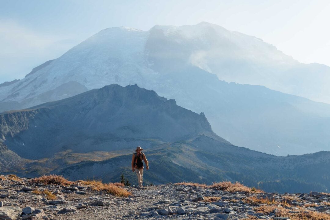
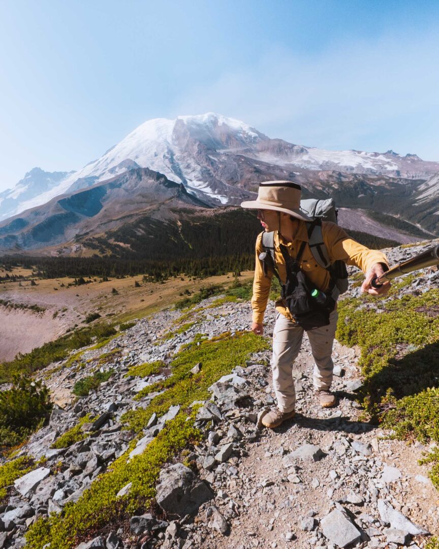
The Curtis Ridge Trail wastes no time. Right from the start, it dips through a meadow framed by trees, with Mount Rainier’s summit towering in the background.


Early on, you’ll be able to trace your route going up the ridge below the summit.
The trail meanders through the meadows before breaking out onto the open ridge. And that’s when you get your first view of the Carbon Glacier from above.

Photos can’t capture the whole experience. Not only do you see the glacier’s massive crevasses and rocky surface, but you hear it:
Sharp cracks echoing as the ice shifts.
Boulders tumbling into unseen depths.
It feels less like a block of ice and more like a living force as it reshapes the landscape.

As you continue higher, the ridge narrows, and the trail begins to fade away. But try as best you can to stay on the trail. The alpine vegetation is fragile.
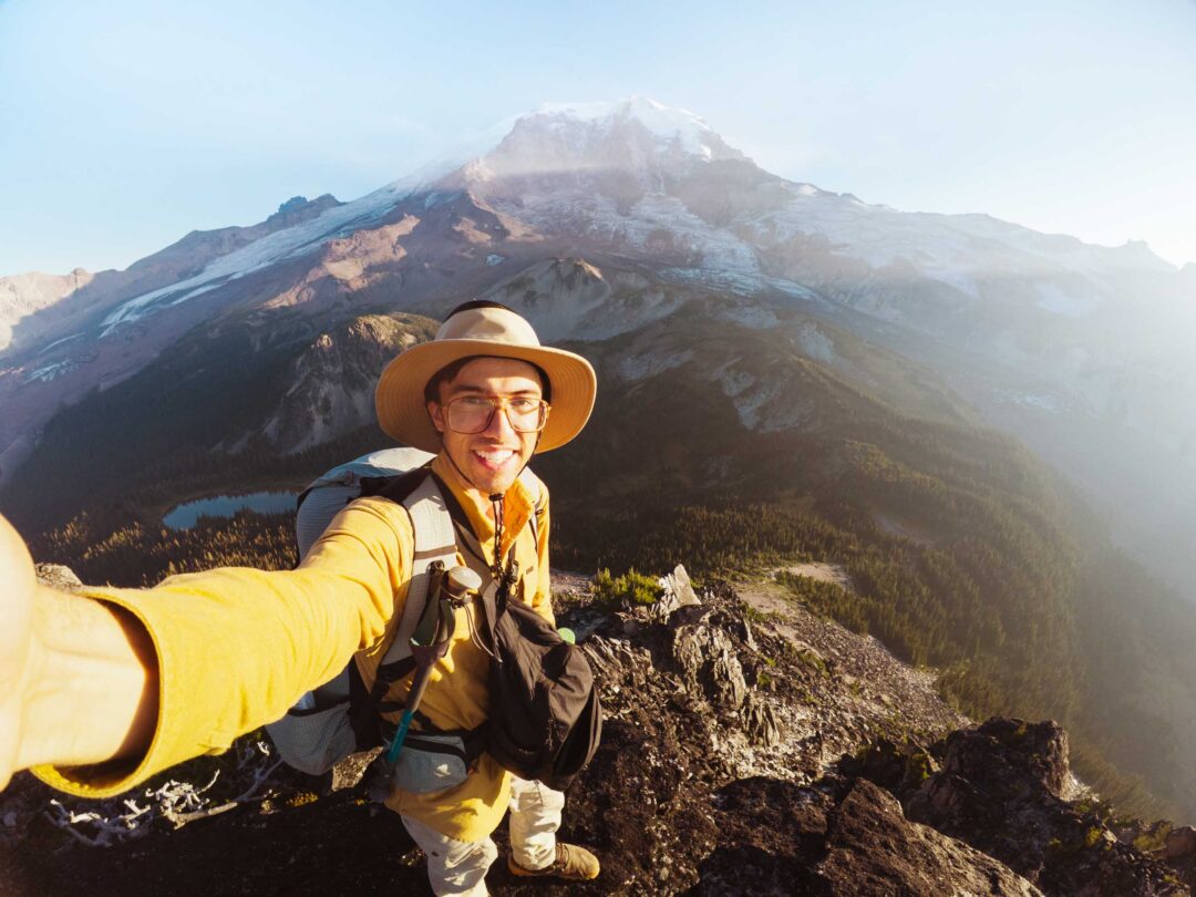
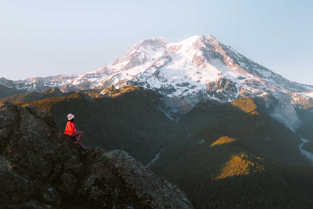
Eventually, the trail tops out at a rocky viewpoint around 7,400 feet. This is the perfect turnaround spot.

In one direction, you’re staring directly at Rainier’s Willis Wall and the gaping maws of the Carbon Glacier. Turn around, and you’re rewarded with views of Mystic Lake, Mineral Mountain, and Old Desolate spread out below you.


It’s an incredible, inhospitable place where all the extremes of alpine landscapes come together.
Curtis Ridge Trail Hike Details
- Important: For most people, the Curtis Ridge Trail can not be done as a day hike. The beginning of the trail is nearly 10 miles one-way from Sunrise. It is simply too far to reasonably tackle in a single day.
- Hike Distance: The total distance of the hike is about 1.8 miles out and back from the cutoff on the Wonderland Trail to the marked endpoint in the GPS track that I will provide below.
- Hike Duration: The Curtis Ridge hike takes approximately 2-3 hours total.
- Hike Difficulty: The trail’s difficulty is moderate. The trail is hard to follow at times, but it is not in difficult terrain. The hardest part of the hike is not going off-trail (use the GPS track). You can also turn around at any point once you’re on the ridge because the views pretty much remain the same.
- Hike Incline: The hike has an elevation gain of about 1500 feet. The trail is uphill almost the entire way out, then downhill on the way back. The final push up to the end of the trail at the rocky viewpoint is the steepest part of the trail.
- Dogs are NOT allowed on this trail because it is located in Mount Rainier National Park.
- A Mount Rainier Entrance Pass is required to hike the Curtis Ridge Trail.

How to get to the trailhead for the Curtis Ridge Trail
The Curtis Ridge Trail begins at the saddle between Old Desolate and Curtis Ridge, along the Wonderland Trail between Moraine Park and Mystic Lake.
Because it’s deep in the backcountry, there’s no direct road access. The nearest trailhead is at Sunrise, which means you’ll need to hike nearly 10 miles just to reach the beginning of the trail.
The cutoff for the Curtis Ridge Trail is easy to miss. Look for the wooden sign that says “Mystic Lake .8” on the Woderland Trail. It’s west of Mystic Lake. Directly behind that sign, you’ll find the start of the Curtis Ridge Trail.
Below is a Google Maps pin that I dropped on the location of the cutoff for the Curtis Ridge Trail.

Curtis Ridge Hike in Mount Rainier: My Experience
My hike up the Curtis Ridge Trail brought me up close to the Carbon Glacier, the Willis Wall, and the icy summit of Mount Rainier itself.
The night before, I camped at Mystic Lake. I woke up and packed my camp in the dark to catch the sunrise.
The early morning air was crisp as I started up the trail, pausing every so often to snap photos of the morning rays hitting Rainier’s summit.

I had already scouted the trail entrance, so I knew where to go. But I wasn’t sure what kind of condition the trail was in. Fortunately, the trail was easy to follow. At least for the first part.
The trail cut into a meadow and wound through some trees. It was so nice to be out there early in the morning before the sun burned over the ridge. It was extremely peaceful.

Once the trees thinned, though, the trail oddly became harder to follow. The path broke out into an open meadow, and I had to pay close attention to stay on it.
It would have been a lot easier to just wander straight up the ridge, but I wanted to do my best to stick to the established trail and minimize my impact on the terrain.


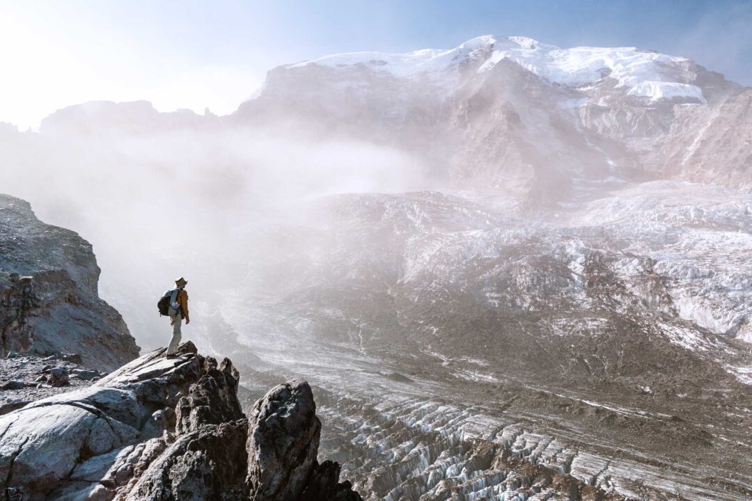
When I finally crested the ridge, I got my first full view of what was below.
The Carbon Glacier sprawled through the cirque. The only thing that separated me from it was the cliff’s edge.
Just the day before, I had gazed at the glacier’s terminus, staring up from 3,000 feet lower. Now I was looking down at the same glacier from above.


But what was even more insane was the view of the Willis Wall, the massive headwall that feeds the glacier. It’s hard to fathom that climbers have actually scaled that icy hell-like barrier. It looked more like the frozen end of the earth than a climbing route.

I pushed higher along the ridge, eager to get closer. The glacier below looked like a river of ice spilling down the mountain. Its crevasses seemed so small from up there, but would surely swallow a bus whole with room to spare.
But what was even more incredible than the sights of the glacier were its sounds.
Creaks and groans echoed out from the ice. A massive boulder tumbled across the glacier’s surface, vanishing into a deep crevasse, leaving behind nothing but the sound of its crash.

The scale of everything on the glacier was amplified. It was like this massive block of ice was alive.
The trail dipped down before rising again toward a rocky outcropping. With the day slipping away, I decided that would be my turnaround point.
At about 7,400 feet in elevation, I stood on that rocky perch, and took in the view of Rainier’s summit and the chaotic wall of ice and stone in front of me.

Strangely enough, being there reminded me of standing at South Point in Hawai‘i or the cliffs of Uluwatu in Bali. Places that feel like the literal end of the earth.
Except here, instead of infinite ocean and distant horizons, the world ended in a wall of ice.
Our Free Mount Rainier Google Maps Locations
Want a free map of all of the locations mentioned in this post? Sign up in the box below and we’ll deliver one right to your inbox, plus our top tips to help you plan your Mount Rainier trip!
More Hikes in Mount Rainier National Park
We’re based in Seattle and have done a ton of hikes in Mount Rainier National Park. To help fellow adventurers, we’ve put together guides to the best trails we found. You can check them out by clicking the links below.
- Our ultimate Mount Rainier hiking guide: 20 Incredible Hikes in Mount Rainier: Complete Travel Guide
- Hike to a subalpine meadow with views of the Tahoma Glacier: Emerald Ridge Hike
- An old fire watch tower sitting atop a rocky peak: Gobblers Knob
- Rocky peak with an unobstructed view of Mount Rainier: Pinnacle Peak
- Explore the wildflower meadows below Rainier at Summerland, or proceed further to glacial moraines of Panhandle Gap
- Wooden fire watch tower with one of the all time best views in Mount Rainier: Fremont Lookout
- The tallest waterfall in Mount Rainier: Comet Falls
- A short hike that has big views without big crowds: Dege Peak
- 3-night backpacking adventure in Mount Rainier: Northern Loop Trail
I hope you enjoyed my guide to the Curtis Ridge Trail in Mount Rainier National Park. Feel free to leave a comment below if you have any questions 🐸