Of all the hikes starting at the Sunrise area of Mount Rainier, Dege Peak flies under the radar.
Why is that?
For one, it’s overshadowed by the more famous Burroughs Mountain and Fremont Lookout hikes. But while both of these incredible hikes go toward the glacier-capped Mount Rainier, the Dege Peak trail goes in the other direction.
The hike to Dege Peak takes you along the Sourdough Ridge away from Mount Rainier. It’s just far enough to give you a more expansive look at the massive mountain among the subalpine landscapes of Sunrise. And while the Dege Peak hike is short, the views are just as good.
In this guide, I’ll share everything you need to know before hiking to Dege Peak in Mount Rainier National Park, including how to get there, what to expect on the trail, and tips from our own experience to help you make the most of your hike to this rocky summit in the Sunrise area of Mount Rainier.


Dege Peak Hike Complete Guide
Dege Peak is a short hike starting at the Sunrise area of Mount Rainier. The trail gives you big views without having to hike big distance, and is perfect if you are looking for a hike in Mount Rainier on limited time. It’s a well-marked, easy/moderate hike with around 600 feet of elevation gain over 4 miles round-trip.
The hike to Dege Peak begins in Sunrise, on the same trail as the famous Fremont Lookout hike. But after a short distance, you’ll reach a junction where these trails diverge. Fremont is left, but you’ll head right toward Dege Peak by following the Sourdough Ridge Trail east.
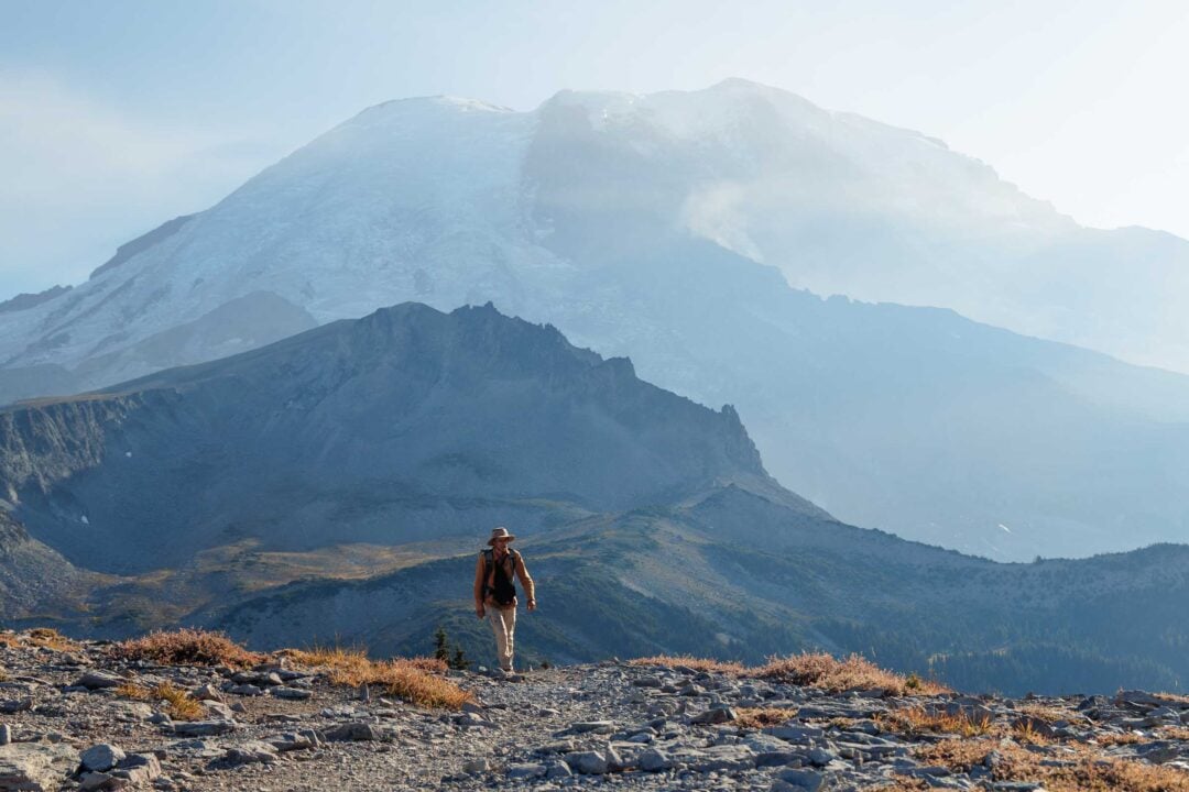
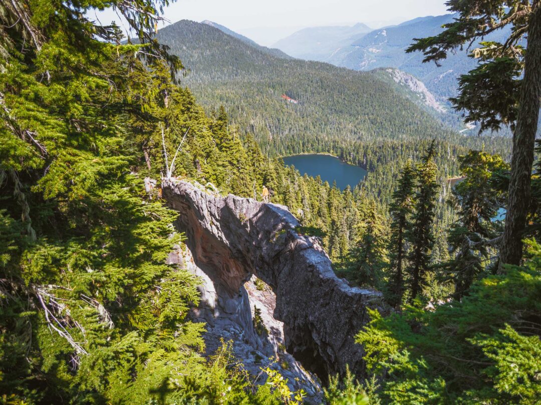
Along the way, the trail follows a dry, exposed ridge. To the left of the ridge is Huckleberry Basin, a valley covered by small trees and rocks. The elevation gain is steady but manageable, and the exposed terrain provides open views most of the way.

When you reach a trail split further along the ridge, stay left and head uphill. Once you get to a switchback in the trail, you’re almost there!
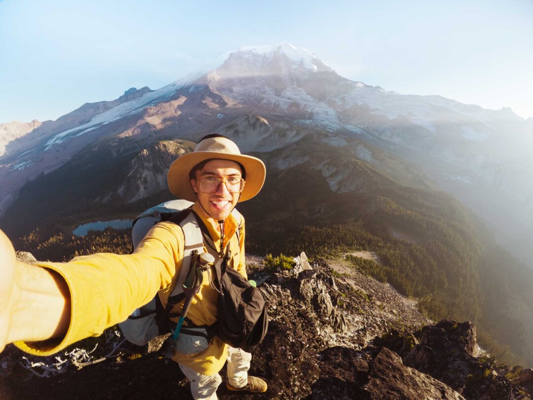
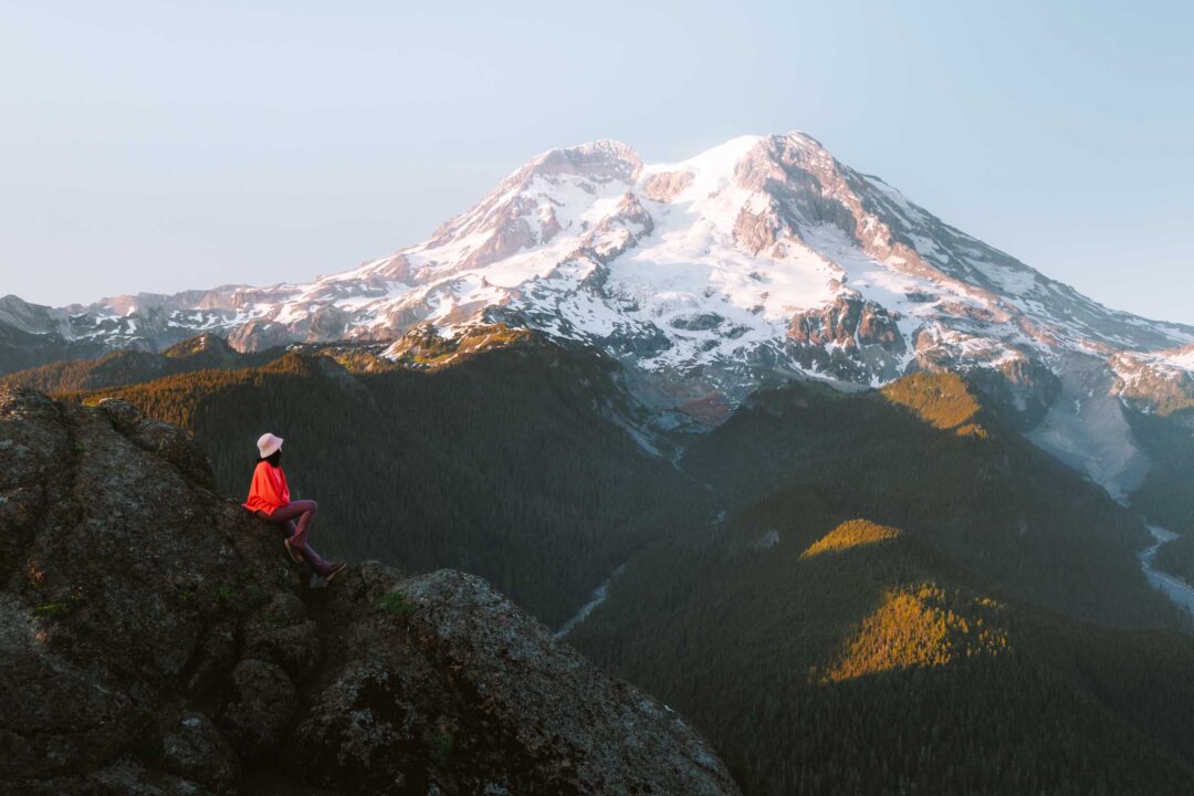
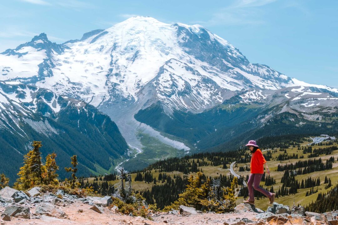
The final climb to Dege Peak opens up to a complete 360-degree panorama of the surrounding area, including Mount Rainier and the Cowlitz Chimneys. On a clear day, you can also spot Mount Adams to the south, Glacier Peak and Mount Baker to the north, and endless ridges stretching across the Cascades.
Dege Peak Hike Details
- Hike Distance: The total distance of the hike is about 4 miles round-trip to Dege Peak and back.
- Hike Duration: The hike takes about 2 hours total, including time spent enjoying the views atop Dege Peak.
- Hike Difficulty: The trail’s difficulty is easy/moderate. It is a short hike but has no shade, so use sun protection and bring at least 1 liter of water.
- Hike Incline: The total incline for this hike is about 600 feet. The trail is uphill the entire way to the Dege Peak.
- Dogs are NOT allowed on this trail because it is located in Mount Rainier National Park.
- A Mount Rainier Entrance Pass is required to hike Dege Peak. Dege Peak is located in the Sunrise area of Mount Rainier National Park and also requires a Sunrise Timed Entry reservation ahead of time.


How to get to the Dege Peak Hike trailhead
The Dege Peak hike begins at the Sourdough Ridge Trailhead in the Sunrise area of Mount Rainier National Park. This is the same starting point for several popular hikes, including the famous Fremont Lookout hike.
But getting to Sunrise comes with some access rules.
Because it’s one of the most visited parts of the park, you’ll need a Sunrise Timed Entry Reservation during the peak summer season. These permits are required for day-use access and can be booked in advance starting in May through the Recreation.gov website. If you miss the initial release, a limited batch of additional tickets becomes available the day before your visit at 7 PM.
The map location below for the start of the Dege Peak hike is accurate and can be used to navigate there.

Dege Peak Hike in Mount Rainier: Our Experience
When we got to the Sunrise area of Mount Rainier, we already had a plan to hike to Fremont Lookout for sunset. But we got to Sunrise in the morning, so I started scanning the map for something to do during the day. I spotted a trail branching off from Sourdough Ridge, leading away from Fremont and toward a place called Dege Peak.
The Dege Peak hike looked short. Hardly any elevation gain. Seemed like the perfect low-effort, high-reward kind of hike. So we grabbed our daypack and headed out.
The trail started on the same trail as Fremont Lookout. Plenty of other hikers were hiking up the trail, too. But once we reached the junction, the crowds continued west toward Fremont. We followed the trail the other way, heading east toward Dege Peak.

The trail followed the ridgeline, gradually climbing up as the Sunrise Visitor Center shrank below us.
It wasn’t too far until we reached the first viewpoint, an overlook above Huckleberry Basin. A few other hikers were hanging out there to enjoy the scenery. The basin was dotted with small trees and a tiny pond. It looked like a place worth exploring on its own someday.

But once we continued along the ridgeline, the other hikers stayed behind. For a while, we had the trail completely to ourselves.
As we hiked, we realized we were saying “Dege” in different ways. Was it dee-gee? day-gee? deege? No clue. We laughed about it and kept going.
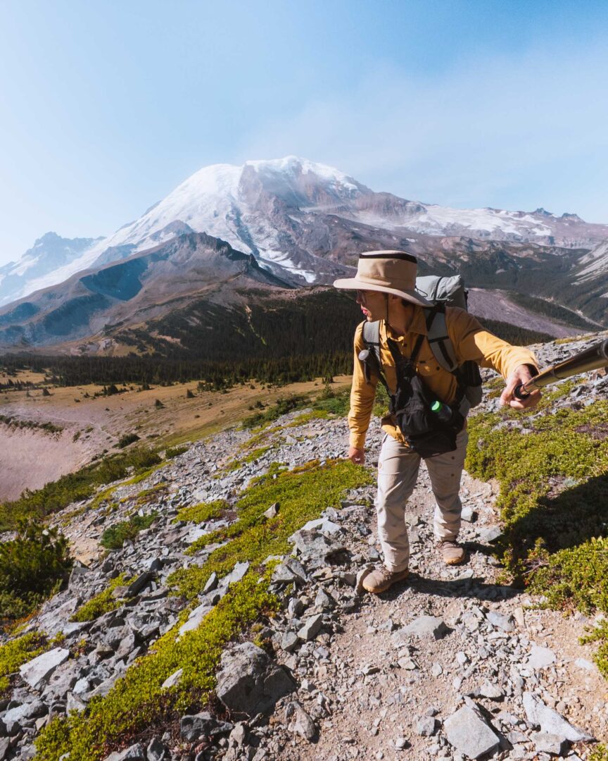
One odd thing about this trail is that it constantly made us turn around. Mount Rainier stood behind us the entire way up. Every few minutes, we stopped to turn around and see the mountain amongst the changing surroundings of the ridgeline and valley. The Sunrise Park road cut across the landscape below us with tiny cars weaving their way into the park, just like we had done that morning.

The trail continued along the ridge, skirting around two smaller peaks, clearly heading toward one final peak. Once the trail made a switchback, I knew we were on the final stretch of trail up Dege Peak.

Once we got to the summit, we met a volunteer named Nancy. With the view open in all directions, she was kind enough to identify the peaks surrounding us. Mount Adams to the south. Glacier Peak and Mount Baker way off in the north.
On Rainier itself, we spotted Little Tahoma jutting off to the left, and the snowy landscape of Steamboat Prow and the Burroughs on the right. She also told us of a climber’s camp tucked behind Steamboat Prow that’s used by those making summit attempts.

But after she left, I remembered that we had one burning question, so I ran after her and asked: How do you even pronounce Dege?
She smiled and said most people go with dee-gee or day-gee. Never deege. Mystery solved.
We sat on the rocks on the summit of Dege enjoying our snacks. While we were distracted by the views, a little chipmunk hopped up from behind the rocks and scurried over to our pack. It clearly knew the drill, looking for a quick snack! I turned around and caught it in the act, but it didn’t even flinch. Sadly for the chipmunk, our pack was zipped up tight. No free lunch today.

But the hike down from Dege Peak was arguably the real show. It was our prime opportunity to soak in the direct view of Mount Rainier. No need to turn around now, as the trail went towards the mountain. By the time we got back to Sunrise, we were stoked at all the amazing views we had for such a short hike.
Dege Peak Trail Photos


Are you following our Washington blog series?
We’re based in Seattle and have done tons of things all over Washington. To help fellow adventurers, we’ve put together guides to the best places we found. You can check them out by clicking the links below.
- Our ultimate Seattle guide: 29 Incredible Things to Do in Seattle
- Our Seattle hiking guide: 11 Incredible Hikes Near Seattle
- Best things to do in Mount Rainier: 12 Unique Things to Do in Mount Rainier
- Our ultimate Mount Rainier hiking guide: 20 Incredible Hikes in Mount Rainier
- Best day trip from Seattle: 11 Awesome Things to Do on Bainbridge Island
- Best winter weekend trip in Washington: 8 Amazing Things to Do in Leavenworth in Winter
Our Free Mount Rainier Google Maps Locations
Want a free map of all of the locations mentioned in this post? Sign up in the box below and we’ll deliver one right to your inbox, plus our top tips to help you plan your Mount Rainier trip!
More Hikes in Mount Rainier National Park
We’re based in Seattle and have done a ton of hikes in Mount Rainier National Park. To help fellow adventurers, we’ve put together guides to the best trails we found. You can check them out by clicking the links below.
- Our ultimate Mount Rainier hiking guide: 20 Incredible Hikes in Mount Rainier: Complete Travel Guide
- Hike to a subalpine meadow with views of the Tahoma Glacier: Emerald Ridge Hike
- An old fire watch tower sitting atop a rocky peak: Gobblers Knob
- Rocky peak with an unobstructed view of Mount Rainier: Pinnacle Peak
- Explore the wildflower meadows below Rainier at Summerland, or proceed further to glacial moraines of Panhandle Gap
- Wooden fire watch tower with one of the all time best views in Mount Rainier: Fremont Lookout
- The tallest waterfall in Mount Rainier: Comet Falls
- A short hike that has big views without big crowds: Dege Peak
- 3-night backpacking adventure in Mount Rainier: Northern Loop Trail

I hope you enjoyed our guide to the Dege Peak hike in Mount Rainier National Park. Feel free to leave a comment below if you have any questions 🐸