The first time I saw a photo of Emerald Ridge, I instantly knew that we had to see it for ourselves. The image was a rock-lined pathway through a green alpine meadow dotted by patches of snow scattered across the ground, with glacier-covered Mount Rainier looming in the background.
From the top of Emerald Ridge, you get front-row views of the massive Tahoma Glacier while hiking through a grassy alpine meadow covered in wildflowers. It’s a special place and honestly looks like it’s straight out of a fantasy. And better yet, this remote area of Mount Rainier National Park doesn’t see nearly as many hikers as the park’s other trails.
In this guide, I’ll share everything you need to know before hiking to the Emerald Ridge in Mount Rainier National Park, including how to get there, what to expect on the trail, and tips from our own experience to help you make the most of your hike to this subalpine meadow in Washington.


Emerald Ridge Complete Hiking Guide
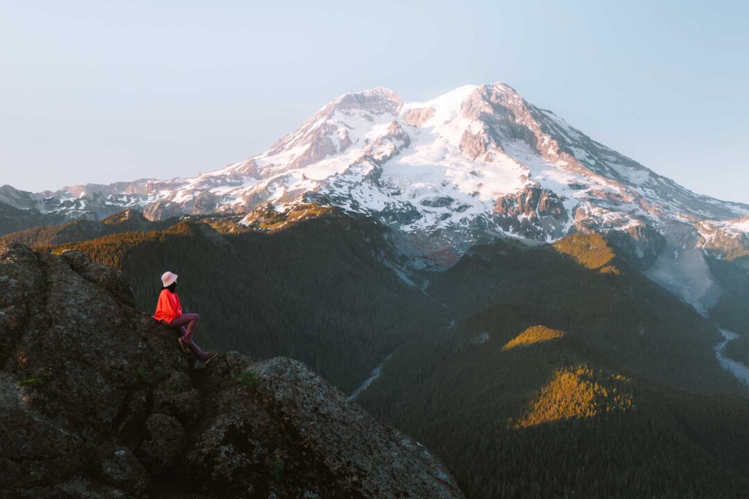
The Emerald Ridge gets its name from the vivid green meadow that blankets its summit. At the top of the ridge is a close-up view of the Tahoma and South Tahoma Glaciers, with Mount Rainier rising in the background. During the summer, wildflowers bloom across the meadow, and waterfalls pour off the glaciers, feeding the rivers below.


The Emerald Ridge hike is a long and hard hike, with about 3500 feet of elevation gain over 14.2 miles round-trip. The trail is well-marked but includes some rough terrain, especially going up the ridge where the trail is loose and rocky.
The hike begins at the start of Westside Road, which is permanently closed to vehicles. From the parking area, you’ll follow the road for 3.7 miles on foot or by bike. It’s a wide gravel road that climbs gradually. After passing the cutoff for the Lake George Trail on your left, keep a sharp eye out for the South Puyallup Trail on the right.
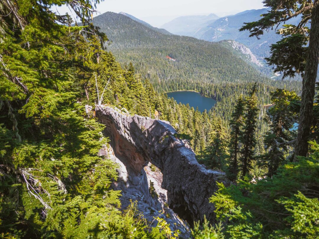
Once on the South Puyallup Trail, you’ll descend into a quiet forest alongside the South Puyallup River, with massive andesite lava columns rising along the opposite cliff face. These hexagonal formations are remnants of volcanic activity from thousands of years ago. It’s a surreal sight tucked away in Mount Rainier’s wilderness.

After another 1.8 miles, you’ll pass through the South Puyallup Camp and then connect with the Wonderland Trail. From there, your climb up the Emerald Ridge begins.
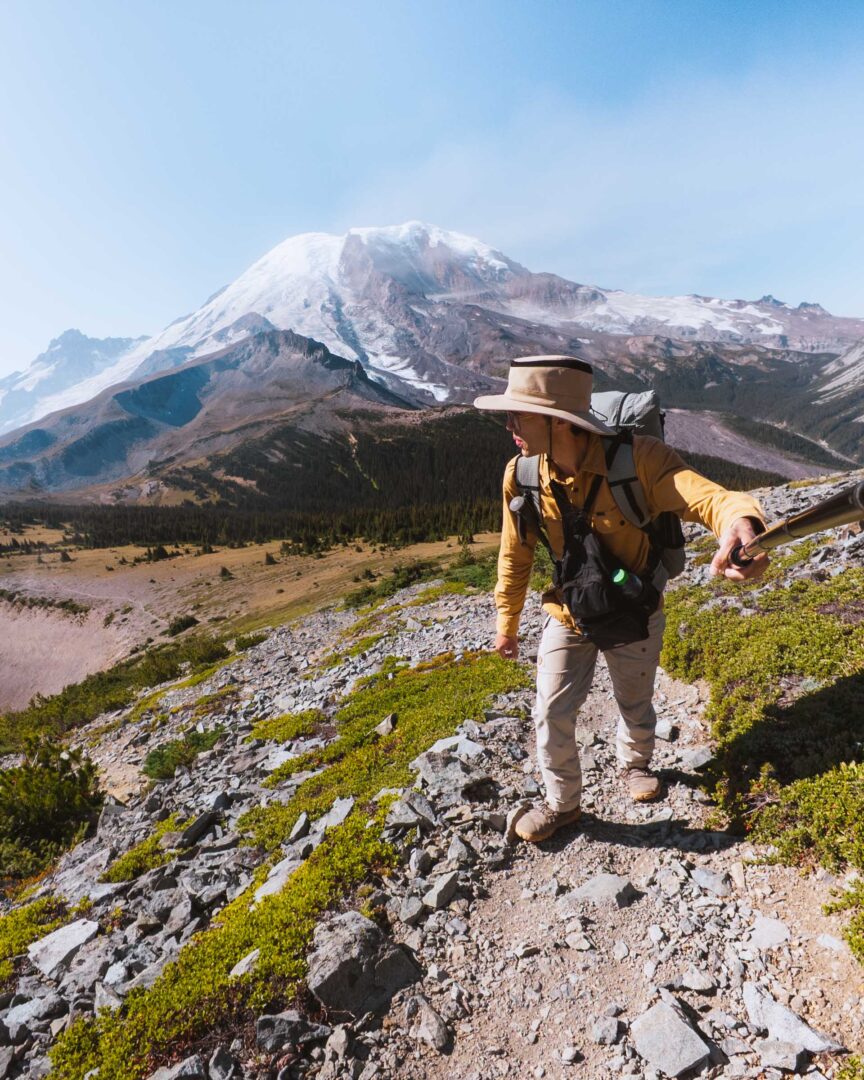
The trail soon turns rocky and uneven, but as you gain elevation, you find yourself beginning to crest the Emerald Ridge, with views of the Tahoma Glacier in sight.


In the summer, waterfalls cascade down the cliffs as the glacier melts, feeding the South Puyallup River and Tahoma Creek.
Take a look to your left at the bright orange moraines in the valley below. The vivid landscape was created by volcanic hydrothermal activity, which chemically transformed the rocks before they were carried downhill by glacial movement.

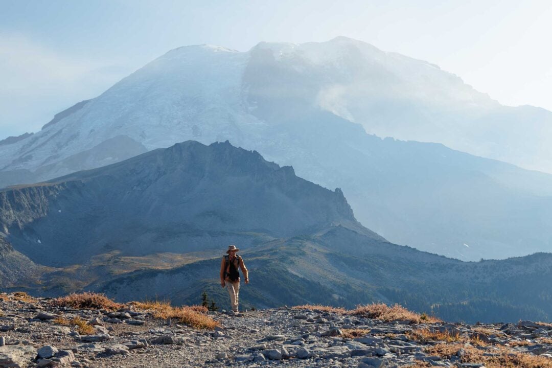
Once you reach the crest of the Emerald Ridge, the rocky slope transforms into a grassy alpine meadow. A narrow, rock-lined trail cuts through open fields of wildflowers, framed by short evergreens. The view opens up, and Mount Rainier’s glacial face soon dominates the backdrop.

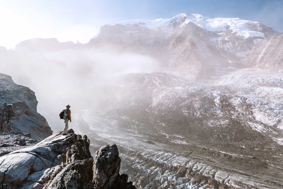
A bit further, and the grassy alpine meadow transforms into a rocky volcanic scene that looks like it’s from another planet.
And while it might feel like you could reach out and touch the summit from there, don’t be fooled. The top of Mount Rainier is still over four miles away, even though it looks much closer.
There’s no climbing route from this side either; the terrain ahead is sheer and inaccessible. From this vantage point, you really get a sense of just how massive and formidable Mount Rainier is.


Emerald Ridge Hike Details
- Hike Distance: The total distance of the hike is about 14.4 miles round-trip to Emerald Ridge and back. It is about 7.2 miles each way; 3.7 miles are spent hiking or biking along the Westside Road, and 3.7 miles are on the trail up to Emerald Ridge.
- Hike Duration: The hike takes about 8-9 hours total, including time spent enjoying the views atop Emerald Ridge.
- Hike Difficulty: The trail’s difficulty is hard. It is a long hike with a ton of incline. Part of the hike is along an exposed ridge with unstable rocky terrain.
- Hike Incline: The total incline for this hike is about 3500 feet. The trail is uphill the entire way to the Emerald Ridge. After you get onto the Wonderland Trail, the trail gets steep and rocky.
- Dogs are NOT allowed on this trail because it is located in Mount Rainier National Park.
- A Mount Rainier Entrance Pass is required to hike to Emerald Ridge. Emerald Ridge is located in the Longmire area of Mount Rainier National Park, and the best access is through the Nisqually Gate.

How to get to the trail for Emerald Ridge
The trail to the Emerald Ridge begins at the entrance to the Westside Road in Mount Rainier National Park. The best way to get there is through the Nisqually Gate on the southwest side of the park.
Westside Road is now permanently closed to vehicles, so your journey begins on foot or by bicycle. From the parking area, it’s a 3.7-mile trek up the unpaved road before you reach the turnoff for the South Puyallup Trail. That trail continues another 1.9 miles along the river through forest, followed by a final 1.8-mile stretch along the Wonderland Trail that climbs to the open meadows of Emerald Ridge.
The map location below for the Westside Road is accurate. That is where you will park and begin your hike to the Emerald Ridge.

Finding the South Puyallup Trail entrance can be tricky. It’s somewhat hidden in the brush about 3.7 miles up Westside Road. We actually walked right past it the first time and had to backtrack. If you come across a stone memorial dedicated to a group of Marines, you’ve gone too far. The trailhead is just before the stone memorial, tucked away on the side of the road in the trees.

Emerald Ridge Hike in Mount Rainier National Park: Our Experience
Before hiking to Emerald Ridge, I expected a lush green meadow covered in wildflowers with snowy mountain views as the backdrop. And it absolutely lived up to my expectations. But what I didn’t expect was everything else we’d find along the way.
As soon as the snow began to melt in June, we packed our gear and went out for our first backpacking trip of the season. The night before our hike to Emerald Ridge, we camped at Lake George and caught the sunset at the Gobblers Knob fire lookout. The next day, we packed up and set off for Emerald Ridge.
As soon as we stepped onto the South Puyallup Trail, it felt like we had entered another world. Compared to the wide, open Westside Road we had just hiked, this trail felt like it was almost forgotten. The entrance itself was barely visible, hidden between the bushes, with the trail sign nearly swallowed by foliage. The trail was narrow, with plants and moss lining the path. Everything seemed still and undisturbed.

Old-growth trees towered above us, and small creeks trickled across the trail. We stopped at one to filter water and take a break.
As I stood beside this tiny stream, I got down on my knees and looked at it from below. With plants growing above the flowing water like a canopy of trees towering above a river, it felt like its own little world. It’s the kind of place I would not mind spending my life in if I were shrunk down to the size of a bug.

But the most surreal part of this section of the trail came just before the South Puyallup Camp. Chloe spotted something through the trees on our right. Massive stone columns rose straight up along the cliffside, like a rocky wave crashing in the forest.

I later learned these hexagonal rock columns are known as the ‘Pipe Organ’. Quite fitting for what it looks like. It was formed by the cooling of lava as it flowed through the valley thousands of years ago.
But all that magic wore off as soon as we passed through the camp and started hiking up the Wonderland Trail. This stretch has a reputation for being one of the loosest and rockiest parts of the entire Wonderland, and I believe it. It’s still a trail, technically, but made of loose stones that felt more like scree than a proper path. Luckily, that part didn’t last long.

As we hiked up the Emerald Ridge, the tree cover began to thin out, and we were under the direct sun. Then, just ahead, we caught our first glimpse of what we came for. Mount Rainier began to pop out from behind the treetops, and soon we were ascending the ridge with the massive Tahoma Glacier coming into view.

I looked down into the valley on our left. Bright orange moraine spread across its floor like soil from another planet, with waterfalls cascading down from above. I had seen that exact patch of orange the day before miles away from Gobblers Knob and now we were standing right above it.
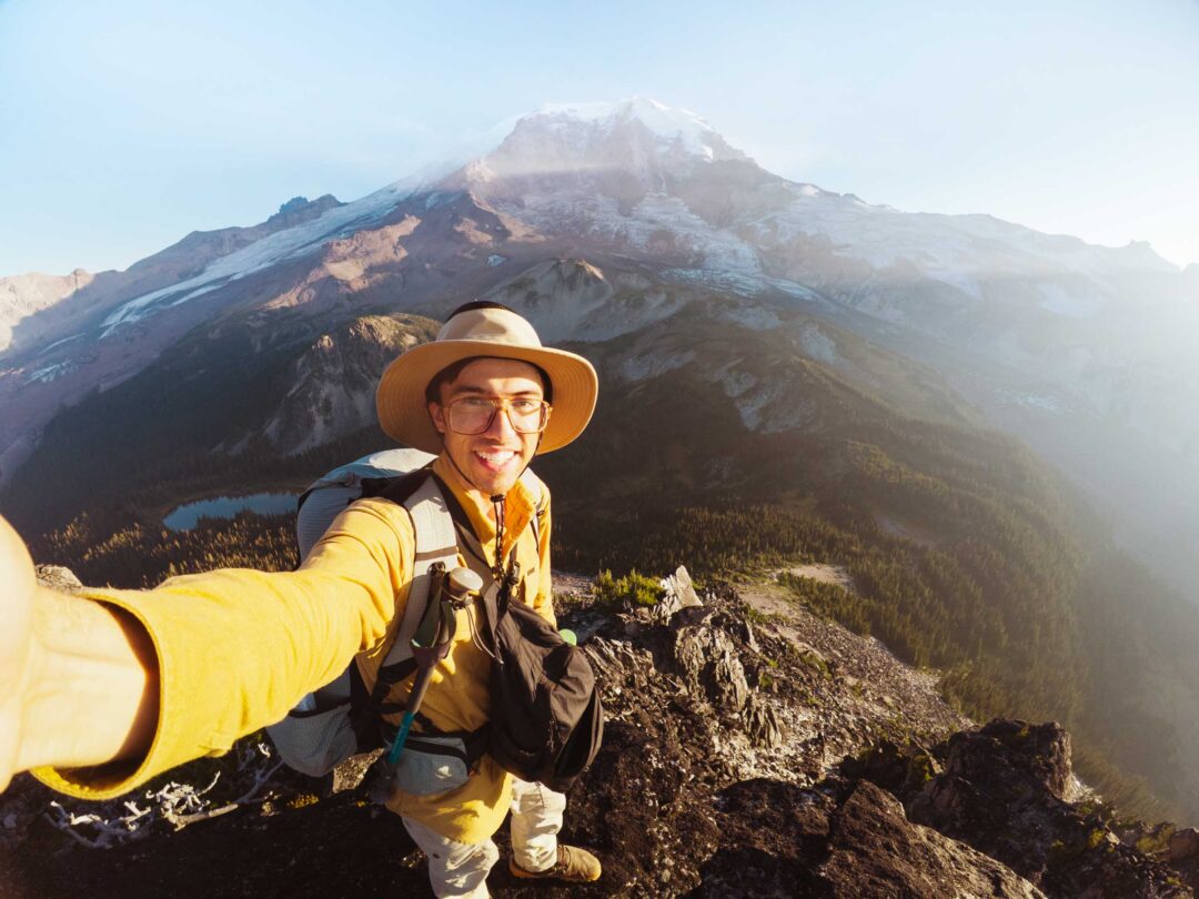
And finally, we reached a place straight out of a dream. The green subalpine meadow at the top of Emerald Ridge. A curious marmot greeted us as we arrived, popping out of its burrow and sniffing the air before turning our way, trying to figure out who had wandered into its alpine kingdom.

As we walked into the meadow, I found the very spot from that photo. It was that narrow trail, lined with rocks, flanked by small trees and fields of yellow flowers against the backdrop of Mount Rainier towering above. It was the kind of place that should only exist in a fairy tale, yet we were here walking through it.

The trail crested the ridge, then dropped down its far side into what I can only describe as a moonscape. The ridge changed from a green meadow to brown volcanic rock.

Back at the meadow, we found a sunny rock to sit and snack on. A pair of backpackers hiking the Wonderland Trail passed by, and I offered to take a photo of them together. I imagined how hard it must be to get a decent picture while hiking a multi-day trek like that, let alone in a place this incredible. They were grateful, and I was glad I could help them commemorate their journey.
But it was getting late in the day, and we knew we had to start the long hike back. We said goodbye to the meadow atop Emerald Ridge and retraced our steps down the mountain, leaving the dreamiest place I’ve ever escaped away to.

Emerald Ridge Hike Photos


Our Free Mount Rainier Google Maps Locations
Want a free map of all of the locations mentioned in this post? Sign up in the box below and we’ll deliver one right to your inbox, plus our top tips to help you plan your Mount Rainier trip!
More Hikes in Mount Rainier National Park
We’re based in Seattle and have done a ton of hikes in Mount Rainier National Park. To help fellow adventurers, we’ve put together guides to the best trails we found. You can check them out by clicking the links below.
- Our ultimate Mount Rainier hiking guide: 20 Incredible Hikes in Mount Rainier: Complete Travel Guide
- Hike to a subalpine meadow with views of the Tahoma Glacier: Emerald Ridge Hike
- An old fire watch tower sitting atop a rocky peak: Gobblers Knob
- Rocky peak with an unobstructed view of Mount Rainier: Pinnacle Peak
- Explore the wildflower meadows below Rainier at Summerland, or proceed further to glacial moraines of Panhandle Gap
- Wooden fire watch tower with one of the all time best views in Mount Rainier: Fremont Lookout
- The tallest waterfall in Mount Rainier: Comet Falls
- A short hike that has big views without big crowds: Dege Peak
- 3-night backpacking adventure in Mount Rainier: Northern Loop Trail
I hope you enjoyed our guide to the Emerald Ridge hike in Mount Rainier National Park. Feel free to leave a comment below if you have any questions 🐸