When we first started our hike to Lake George, I had my doubts. The hike began on a long, unpaved service road, fully exposed to the sun. There was no shade, and honestly, it felt more like a marathon than an adventure.
But once we hit the Lake George trail cutoff, everything changed. The path dipped into the shade of the forest as we walked into a completely different place. Once we got to the lake, we found a beautiful area with campsites, a shelter, and a little spot for swimming along the lake’s shores. It’s an awesome area, and I’m glad it isn’t as popular as some of the other trails in Mount Rainier National Park.
In this guide, I’ll share everything you need to know before hiking and camping at Lake George, including how to get there, what to expect on the trail, and tips from our own experience to help you make the most of your hike to this lake in Mount Rainier National Park.


Lake George Hike Complete Guide
Lake George is a hike on the western side of Mount Rainier National Park. Most of the route is along an old road, but the payoff at the lake is worth it. It’s a well-marked hike with about 1,500 feet of elevation gain over 9 miles round-trip. It’s moderately challenging but doable for most hikers and is a great option for both day hikes and overnight backpacking.
The hike to Lake George starts at the gate to the West Side Road, just off the main park road near the Nisqually Entrance. This old road was originally intended to wrap around the entire mountain but was never completed. After repeated washouts, it’s been closed to vehicles since 1989, but it remains open to foot and bike traffic.

For the first 3.5 miles, you follow the road as it gradually climbs uphill alongside the Tahoma Creek. Along the way, you’ll pass remnants of the road’s past, including a hairpin turn known as Tahoma Vista. The turn is supported by a rock retaining wall, and the area was once a scenic lookout with a view of Mount Rainier, now obscured by alder and fir trees.

From Tahoma Vista, it’s another 1.5 miles to the Lake George Trail cutoff. Keep an eye out for a large bike rack made from a massive log on the left side of the road. If you biked in, this is where you’ll lock up and transition to hiking.
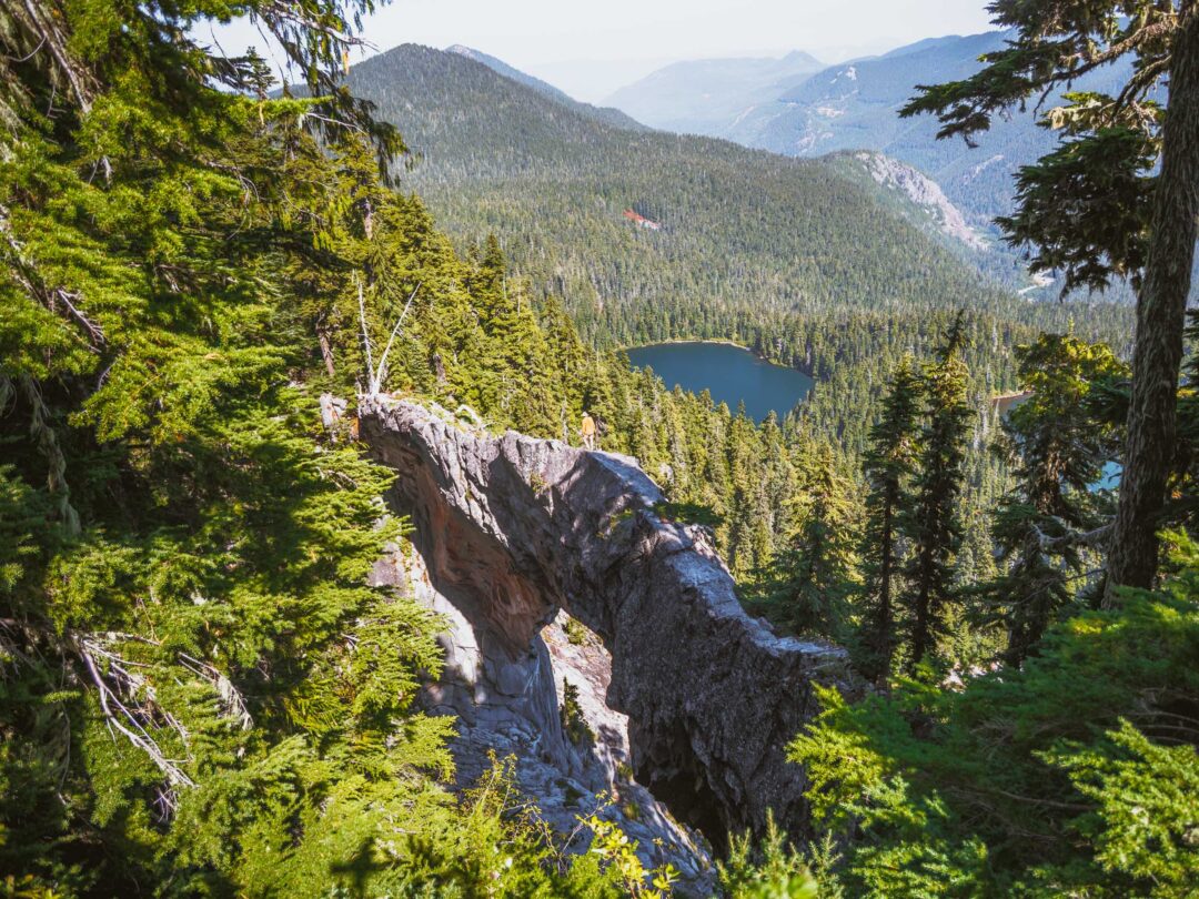
From the Lake George Trail cutoff, it’s just 0.9 miles to Lake George. The trail dips into a cool, shaded forest of Douglas fir and western hemlock, which is a nice change from the open road you just came from.


Once you reach Lake George, you’ll find a handful of backcountry campsites, a wooden shelter, and an outhouse. It’s a great place to rest, have a snack, fish, or take a swim in the cold lake water.
Follow the faint trail along the east (left) side of the lake. It’s slightly overgrown in places but easy to follow. You’ll cross a couple of small outflow streams that make excellent water sources and quiet little spots for swimming or relaxing by the water.


Lake George Hike Details
- Hike Distance: The total distance of the Lake George hike is about 9 miles round-trip. It is 4.5 miles each way; 3.6 miles are spent hiking or biking along the Westside Road, and the remaining 0.9 miles are on the trail to Lake George.
- Hike Duration: The hike takes about 5 hours total, including time spent relaxing at the Lake and the return trip.
- Hike Difficulty: The trail’s difficulty is moderate, but only because of its distance. It is not a challenging hike; it is just kind of long.
- Hike Incline: The total incline for this hike is about 1500 feet. The trail is uphill the entire way to Lake George, but most of the hike is along an old unpaved road, and the incline is gentle.
- Camping: There are 5 campsites and 1 group campsite at Lake George. Reserve your Lake George Campsite ahead of time, or on a first-come, first-served basis in person the day before or the day of your camp at the Longmire Wilderness Information Center.
- Dogs are NOT allowed on this trail because it is in Mount Rainier National Park.
- A Mount Rainier Entrance Pass is required to hike to Lake George. Lake George is located in the Longmire area of Mount Rainier National Park, and the best access is through the Nisqually Gate.

How to get to the Lake George Hike Trailhead
The hike to Lake George begins at the gate to the Westside Road in Mount Rainier National Park. The best way to get there is through the Nisqually Gate on the southwest side of the park.
The Westside road has been closed to vehicles for years due to washouts, but it remains open to hikers and cyclists. To get to Lake George, follow the West Side Road on foot or by bike for 3.6 miles, then hike another 0.9 miles on the Lake George Trail itself.

The map location below for the Westside Road is accurate. That is where you will park and begin your hike to Lake George.

Lake George Hike: Our Experience
When I first booked a campsite at Lake George, I was a little skeptical. It’s kind of off on its own along the Westside Road, and most of the approach isn’t even on a trail; it’s just a service road.
So we set off with low expectations. And honestly, the first part of the hike lived up to them. The road walk was a hot slog up a wide, unpaved road. As it followed along Tahoma Creek, there were a few views of Mount Rainier that kept things interesting for a bit. But once the road started climbing in switchbacks, the scenery got repetitive. Gravel road flanked by forest. Peaceful, but dull.

By the time we reached the Lake George trail cutoff, we were more than ready for the change of pace. Finally! An actual trail.
As soon as we stepped into the forest, the air became cooler, and the sunlight filtered through the trees as the trail slowly climbed uphill.

And then we got to the lake.
Lake George exceeded my expectations in every way. It had clean, clear water surrounded by old-growth forest. The area had a sense of stillness that you don’t get at the more popular spots in the park.
Every campsite was open, so we had our pick. We chose Campsite #5, which had the best view of the lake. We dropped our packs, grabbed a towel, and then followed a faint trail that wrapped around the lake’s eastern shore. Chloe was smart and grabbed our bear can full of food so we had something to snack on. She’s a food-first type of girl.

We crossed two small outflows before finding a log jutting into the lake. A perfect place for a swim.
I jumped into the lake and it took my breath away. Literally. The cold plunge always does that to me. But it felt amazing. So much so that once I climbed out, I jumped back in again. Chloe did the same, and we spent half an hour swimming around, eating snacks, and playing on the lakeshore.

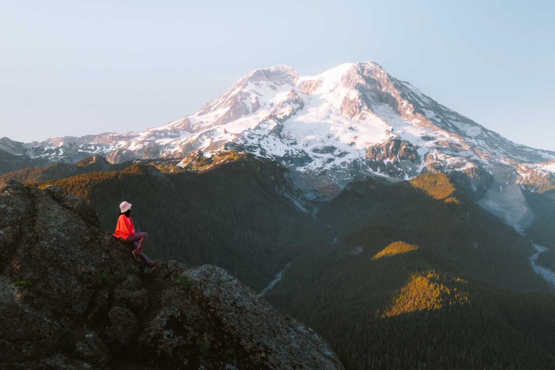
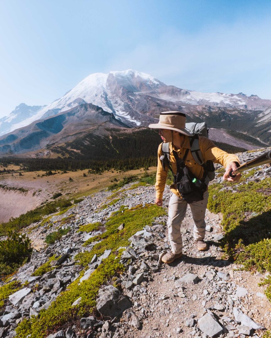
We dried off and made the hike up to Gobbler’s Knob to catch the sunset. It was an incredible spot with panoramic views of the area, including an unobstructed view of Mount Rainier.
By the time we returned to Lake George, it was dark. We set up our tent under clear skies and went to sleep without the rainfly on. Lying in the tent and looking up through the treetops was the perfect Washington summer night.
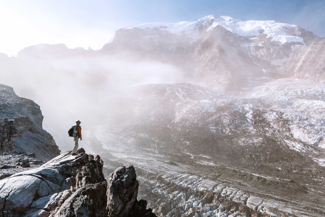
The next morning, we packed up and hiked up the Emerald Ridge for a closer view of the Tahoma Glacier before heading back down the West Side Road to wrap up what turned out to be one of our favorite backpacking trips in Mount Rainier National Park.
Photos of campsites at Lake George
While we were at Lake George, we took photos of the 5 individual campsites there. If you are curious about what the campsites look like at Lake George, I have included them below:


Lake George Hike in Mount Rainier Photos
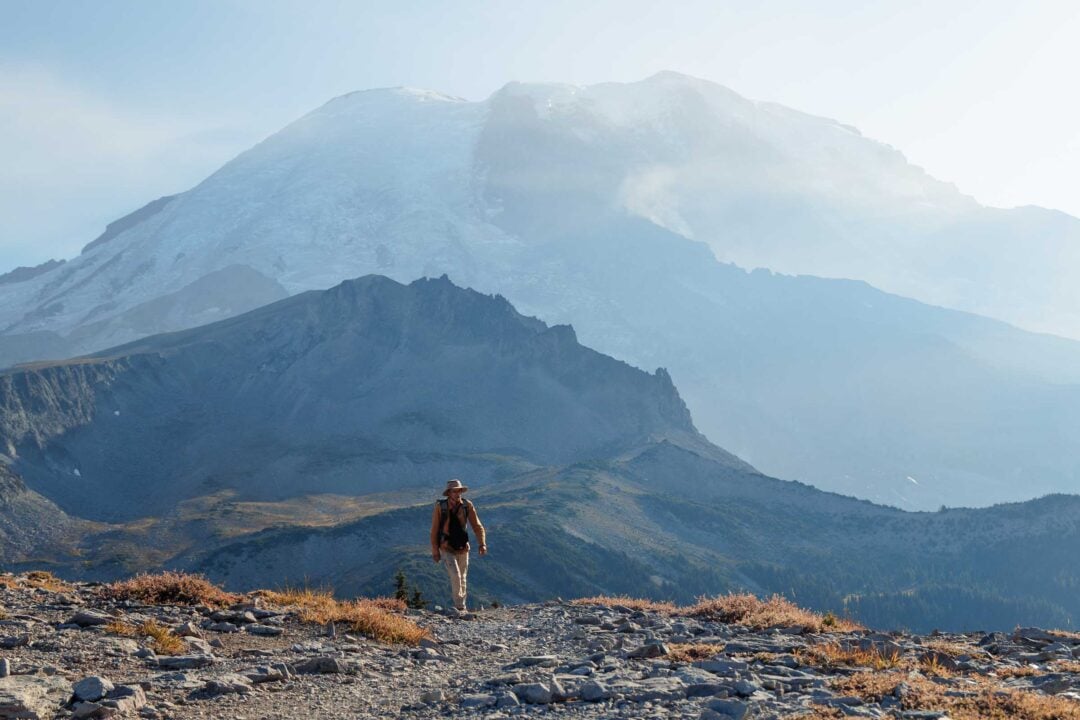
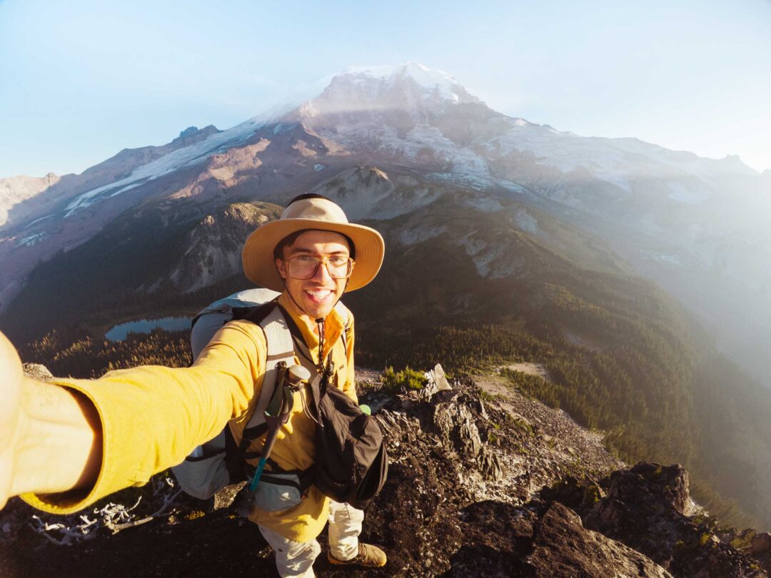
Here are more photos of our hike to Lake George to give you an idea of what the trail is like.


Our Free Mount Rainier Google Maps Locations
Want a free map of all of the locations mentioned in this post? Sign up in the box below and we’ll deliver one right to your inbox, plus our top tips to help you plan your Mount Rainier trip!
More Hikes in Mount Rainier National Park
We’re based in Seattle and have done a ton of hikes in Mount Rainier National Park. To help fellow adventurers, we’ve put together guides to the best trails we found. You can check them out by clicking the links below.
- Our ultimate Mount Rainier hiking guide: 20 Incredible Hikes in Mount Rainier: Complete Travel Guide
- Hike to a subalpine meadow with views of the Tahoma Glacier: Emerald Ridge Hike
- An old fire watch tower sitting atop a rocky peak: Gobblers Knob
- Rocky peak with an unobstructed view of Mount Rainier: Pinnacle Peak
- Explore the wildflower meadows below Rainier at Summerland, or proceed further to glacial moraines of Panhandle Gap
- Wooden fire watch tower with one of the all time best views in Mount Rainier: Fremont Lookout
- The tallest waterfall in Mount Rainier: Comet Falls
- A short hike that has big views without big crowds: Dege Peak
- 3-night backpacking adventure in Mount Rainier: Northern Loop Trail

I hope you enjoyed our hiking guide to Lake George in Mount Rainier National Park. Feel free to leave a comment below if you have any questions 🐸