When the topic of backpacking in Mount Rainier comes up, most people immediately think of the Wonderland Trail.
But it’s not the only backpacking route in the park.
The Northern Loop Trail is a much shorter route, tucked away in the park’s remote northern wilderness. It’s lesser-known than the Wonderland Trail but no less epic.
The Northern Loop Trail goes through wide-open alpine meadows, across a rugged mountain pass, and into remote valleys that most visitors to the park have no idea even exists.
I backpacked the Northern Loop in Mount Rainier and put together this guide to share everything you need to know before hiking the trail.
I’ll also share my own personal experience backpacking the Northern Loop Trail, including a few side-hikes that I did, so you can get an idea of what this remote area of Mount Rainier has to offer.


Mount Rainier Northern Loop Complete Backpacking Guide
The Northern Loop is a 32-mile backpacking trail that links together the Northern Loop Trail and a short section of the Wonderland Trail to form a route through Mount Rainier’s remote northern wilderness.
Starting from the Sunrise area, the Northern Loop Trail branches off from the Wonderland Trail at Berkeley Park and reconnects near Carbon River.
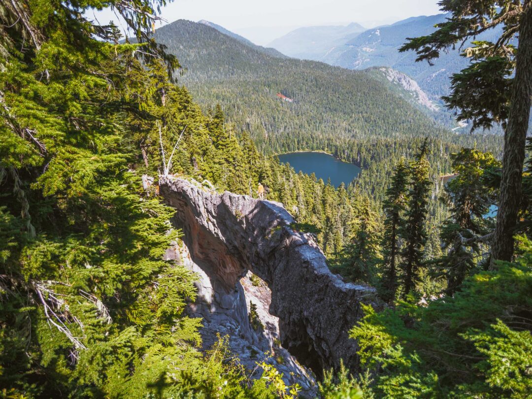
Along the way, the Northern Loop Trail passes through Berkeley Park, Grand Park, Lake James, Windy Gap, and Yellowstone Cliffs. There’s also the Natural Bridge, a rock formation that can only be reached by backpacking into this part of the park.
Unlike the Wonderland Trail, the Northern Loop Trail trades views of Mount Rainier for remote wilderness. It goes through a quiet area of the park. When I hiked the Northern Loop Trail, I rarely saw other hikers.
Most people hike the Northern Loop as part of a 3- to 4-night trip. You get the best of both worlds: remote wilderness on the Northern Loop Trail, and views of Mount Rainier on the Wonderland Trail. The best of both worlds.
In this guide, I’m not going to tell you what to pack or how to backpack. Instead, I’ll give you specific info you actually need before backpacking the Northern Loop:
- How to get a backpacking permit
- What the campsites are like
- What to expect from the trail conditions
- Optional side hikes
- My own personal experience hiking the Northern Loop

How to get a permit for the Northern Loop Trail
Permits for the Northern Loop Trail are issued the same way as any other wilderness permit in Mount Rainier National Park. You’ll need a backcountry permit that reserves your campsites for each night on the trail. There are three ways to get one:
1. Early Access Lottery
- Opens: February
- Details: Submit an application to the Early Access Lottery at Recreation.gov. If you’re selected, you’ll get early access to reserve wilderness permits before they open to the general public.
2. General On-Sale
- Opens: April
- Details: After the early access lottery closes, the remaining wilderness permits are released to everyone else. These can be reserved online at Recreation.gov for trips between June 1 and October 10.
3. Walk-up Permits
- Opens: Day-of or day-before your trip.
- Details: A portion of each wilderness campground is reserved strictly for walk-ups only. Walk-up permits are issued at any Wilderness Information Center.
You can also combine these methods. For example, you can reserve a campsite for your first night on the trail, then on the day of your trip, you can try to get a walk-up permit for the other campsites for your trip.

Northern Loop Trail Hike Details
- Hike Distance: The total distance of the hike is about 32 miles if you start from Sunrise.
- Hike Duration: Most people complete the northern loop in 4-5 days (3-4 nights).
- Hike Difficulty: The trail’s difficulty is moderate/hard. Most of the trail is in good shape, but there are some rough and steeper parts. But there is absolutely no scrambling, and all the trails are maintained because it is located in a national park.
- Hike Incline: The hike has a total elevation gain of about 12000 feet. It goes up and down. Big uphills are followed by big downhills. There aren’t many flat sections of the trail.
- Dogs are NOT allowed on this trail because it is located in Mount Rainier National Park.
- A Mount Rainier Entrance Pass and a wilderness permit are required to backpack the Northern Loop Trail.


Northern Loop Optional Side-Hikes
In my opinion the best part about Northern Loop is that it gives you access to areas that you would not be able get to on a day hike.
Here are a few side-hikes that you can do while backpacking Mount Rainier’s Northern Loop:
Skyscraper Mountain
Skyscraper Mountain is a peak that provides a sweeping 360° panoramic view of the surrounding area, including Mount Fremont, Berkeley and Grand Parks, the Winthrop Glacier, the Burroughs Mountains, and, of course, the massive north face of Rainier itself.
It’s located between Berkeley Park and Granite Creek, and summiting Skyscraper Mountain will add about an hour to your hike.
Read my full blog post: Skyscraper Mountain in Mount Rainier: Complete Hiking Guide


Natural Bridge
The Natural Bridge is a unique spot that’s only really accessible if you hike the Northern Loop.
It’s located near the Windy Gap, and it’s 0.7-mile side trail to get there. The trail is unofficial and unmaintained, but there’s an official park sign marking its beginning.
At the Natural Bridge viewpoint, there is a makeshift railing made from logs where you can observe the Natural Bridge from afar, or you can hike down below and walk on the Natural Bridge like I did.
Hiking to the Natural Bridge will add about 1-1.5 hours to your hike.
Read my full blog post: Natural Bridge in Mount Rainier: Complete Hiking Guide


Curtis Ridge Trail
The Curtis Ridge Trail is a hike in itself, but totally worth it.
The trail goes up the sidewall of the Carbon Glacier, giving you an up close view of the icy Willis Wall and Mount Rainier’s summit. And as you climb higher, you’ll find yourself staring straight down at the Carbon Glacier and the massive cirque it has carved out.
Photos can’t capture the whole experience. Not only do you see the glacier’s massive crevasses and rocky surface, but you hear it. Sharp cracks echoing as the ice shifts. Boulders tumbling into unseen depths.
Hiking the Curtis Ridge Trail will add about 2-3 hours to your hike.
Read my full blog post: Curtis Ridge Trail in Mount Rainier: Complete Hiking Guide


Old Desolate
Old Desolate is hardly a hike, more like a rugged scramble up the side of a steep, rocky peak.
It’s located near Mystic Lake, and I go into full detail below on the Day 3 section of my experience.
For the vast majority of hikers, I would not recommend going up Old Desolate. But if you like doing class 3 scrambles or are a rock climber it’s probably something you’d enjoy.


Our Free Mount Rainier Google Maps Locations
Do you need a handy map with all our Mount Rainier locations? We’ve got a Google Map with all the Mount Rainier locations in this post (plus a LOT more). Sign up in the box below and we’ll deliver it right to your inbox, plus our top tips to help you plan your Mount Rainier adventure.
Northern Loop Trail Campsites
There are 8 backcountry campsites commonly used on the Northern Loop backpacking route. Four are located directly on the Northern Loop Trail, and the other four are on the Wonderland Trail, which forms the southern portion of the loop.
Berkeley Park, Fire Creek, James, and Yellowstone Cliffs camps are on the Northern Loop Trail.
Carbon River, Dick Creek, Mystic, and Granite Creek camps are on the Wonderland Trail, so they tend to be more competitive to reserve.
Below, I’ll share my thoughts and some photos of each campsite along the Northern Loop to help you get an idea of what to expect.
Berkeley Park
Berkeley Park Camp is the most accessible Northern Loop campsite if you’re starting your trip from Sunrise. It’s often used as a first or last night stop because it’s only about 3 miles from Sunrise.
Berkeley Park itself is one of the most beautiful subalpine meadows in Mount Rainier. Rolling green meadows framed by rocky mountains, with a small creek winding right through it all. It’s in an area known for bears and goats, so keep your camera close by.
The Berkeley Park camp is tucked away in a shaded forested area, so it’s not quite as scenic as the park itself. But it’s only a short walk to reach the more photogenic parts of the valley if you want to hang out with a view.
- Berkeley Park Campsites: 2 individual + 1 group


Fire Creek
Fire Creek Camp isn’t going to blow you away with its scenery, but it sits in a key location as a practical first or last night camp on a Northern Loop backpacking route.
The campsite is located about 0.4 miles off the main trail, which is in my opinion, its biggest downside. That’s nearly a full mile just to get in and out of camp.
The camp itself is forested, with no views. But it has peace and quiet. During my night at Fire Creek, it was dead silent, totally wind-sheltered, and had a very relaxed, tucked-away feel. The campsites are well-spaced, with decent privacy from one another.
By late summer, the water source was a trickle, so bring a water filter.
- Fire Creek Campsites: 3 individual + 1 group


James Camp
Lake James Camp is another forested campsite located just uphill from Lake James itself. It’s not particularly scenic in terms of views from camp, but its proximity to the lake gives it a bit more character than some of the other wooded campsites.
The area around the lake is loaded with blueberry bushes, so it’s a great snack stop if you’re passing through during berry season (late summer).
- James Camp Campsites: 3 individual, 1 group


Yellowstone Cliffs
Yellowstone Cliffs Camp is set in an absolutely beautiful area. From the campsite, you get a view of the towering Yellowstone Cliffs. Despite the name, the cliffs aren’t actually yellow. Either way, the area is incredible.
One of the campsites has a clear view of the cliffs, making it a prime spot for sunset. It’s one of the most photogenic places on the Northern Loop.
The downside is that there are only two campsites, and they’re fairly close together. Privacy is minimal.
Regardless, Yellowstone Cliffs is at the top of my list for my next Northern Loop backpacking adventure.
- Yellowstone Cliffs Campsites: 2 individual, 0 group


Carbon River
Carbon River Camp sits at the low point of the Northern Loop route, right where the Wonderland Trail and Northern Loop Trail reconnect.
The entrance to the camp is memorable. First, you cross over the Carbon River suspension bridge. Then, you walk across a footbridge over Cataract Creek, where just upstream a multi-tiered waterfall cascades. It’s the most scenic water source on the trail.
The individual campsites are pretty tight. My own site was multi-tiered, with just enough space for two tents. It worked fine for me, but it would be a squeeze for more than two tents.
- Carbon River Campsites: 4 individual + 1 group


Dick Creek
Dick Creek Camp is a small campsite located right on the Wonderland Trail. It only has two individual sites, so it’s one of the smallest camps on the loop. The sites are also close together, so not much privacy either.
One of those sites overlooks the Carbon River Valley, so it has an awesome view. The water source was good when I passed through it during late season. Overall, it’s a decent camp and I would have no problem spending a night there.
- Dick Creek Campsites: 2 individual


Mystic Camp
Mystic Camp is set in a forested area near Mystic Lake.
There are seven individual campsites there located in a forested area. But they’re all pretty large and well-spaced out. You won’t get total solitude, but you won’t feel crammed in either.
Individual Campsites #6 and #7 are located near the creek, and when I camped there they were much colder than the others. Something to keep in mind.
The Mystic Camp group campsite is notable. It’s massive, easily the biggest group campsite on the loop. It even has its own bear pole and water source. I would honestly not mind spending a few nights there if I was with a group.
- Mystic Camp Campsites: 7 individual + 1 group


Granite Creek
Granite Creek Camp is located in another forested area.
Individual campites #1 and #2, along with the group site, are situated just off the main trail and easy to access. Individual campsite #3 is tucked a bit farther away, down a short spur trail, but it is massive.
Granite Creek runs nearby and is a great place to relax and refill water. Even late in the season when other creeks were drying up, Granite Creek was still flowing steadily during my visit. The creek isn’t big, but it was a nice place to take a break.
- Granite Creek Campsites: 3 individual + 1 group


Northern Loop Trail: My Experience
Sometimes, you go into an adventure with a solid plan.
Other times, you go in with a rough idea and hope for the best.
My adventure on the Northern Loop Trail in Mount Rainier was the latter.
With a week of clear weather in the forecast, I drove out to the White River Wilderness Information Center to get a walk-up permit. The summer rush of backpackers had finally started to die down, and with a good mid-September weather forecast, I crossed my fingers as I approached the park ranger’s desk.
She pulled out a map, and after a couple of minutes discussing possible routes, we came up with a three-night itinerary: Fire Creek, Carbon River, and Mystic Lake.
It wasn’t my ideal route, but with walk-ups, you take what you can get.
Day 1: Sunrise to Fire Creek

I started from the Sunrise area, and hit the Sourdough Ridge Trail around 8 a.m.
I knew it was going to be windy on my first day, but the gusts were intense. As I passed Frozen Lake, the wind was howling, sending dirt and dust flying across the landscape.

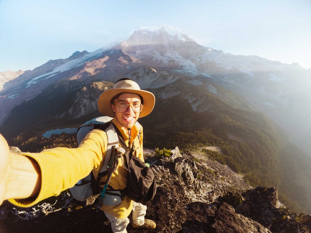
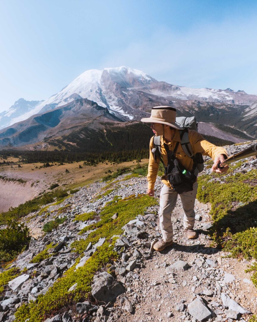
Once I got to Berkeley Park and reached the Northern Loop cutoff, I realized I had more time than expected. So I decided to add in a detour up to Skyscraper Mountain.
As I climbed Skyscraper, those wind gusts turned into full-on gales. Step by step, the winds whipped harder. I’m not sure if it was the elevation or just how the mountain funneled the gusts, but the higher I went, the more intense the wind got. More than once, I had to brace myself to keep from getting knocked off my feet.
Looking back, I still can’t decide whether hiking to the summit was a mistake or just a story I was meant to collect.
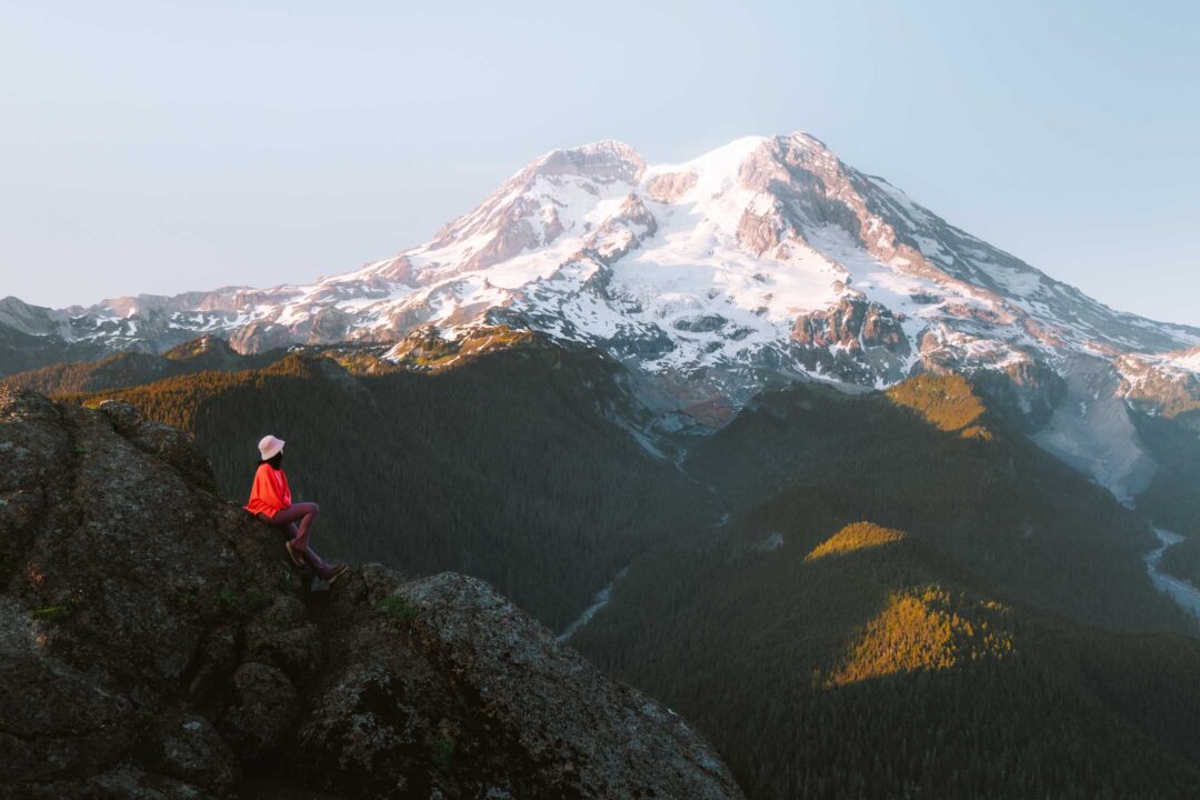
By the time I reached the summit, the winds were excruciating – but the views were spectacular. The summit of Rainier, Grand Park, Berkeley Park, and the Burroughs were all visible in one sweep.
I snapped a few quick photos, but I didn’t spend much time up there to savor the moment. I had to get down for my own safety.

I’d already gone for a crazy ride, and it was just the start of my hike!
I retraced my steps back down into Berkeley Park and finally made the official turnoff for the Northern Loop Trail.
So, a little bit about Berkeley Park. It’s known for two things: wildflowers and bears.
I kept a close eye out for big creatures, but instead of bears, I walked right up to a different kind of animal – a herd of mountain goats. I’ve had a dicey mountain goat encounter before, so I kept my distance. Thankfully, these goats gave me no problems, and I skirted past them without incident.


The more I descended into Berkeley Park, the more the terrain shifted into something straight out of a dream. Gently sloping meadows broken up by patches of evergreen trees, all given life by a crystal clear mountain creek running right through the middle.

But after walking past the Berkeley Park campsites, the landscape turned into a densely forested area. I followed the trail downhill for a while, anxiously waiting for it to bottom out. It finally turned uphill again, and I began the slow climb up to Grand Park.
I guess you could say that this wasn’t my first encounter with Grand Park. I had spotted it from the Fremont Lookout Tower a few months earlier. Chloe and I gave Grand Park the nickname of “Mount Rainier Golf Course” because during the height of summer, its green meadows looked like the carefully manicured fairways of your local country club.
But that was the summer. It was autumn now. So instead of a green meadow, Grand Park had shifted into a sea of yellow and brown in anticipation of the coming winter.


Once I passed through Grand Park, the sun started to set. I trudged down the trail, making my way to Fire Creek. Judging by the map, I thought that it was much closer.
But the trail’s steep switchbacks deceived me.
And once I got to the cutoff for Fire Creek, it was still another 0.4 miles to the actual campsite. I made it there as the day turned into dusk.

Fire Creek camp itself was nothing special. Just a forested patch with a few big, flat sites. Not much to look at, but it was quiet and sheltered from the wind.
The only real downside was that the water source was more of a trickle this late in the season. It was full of debris, so I was glad that I brought a water filter.
Usually, on the first night of a backpacking trip, I have trouble sleeping. But that night I slept well. Maybe it was because I was tired. Maybe it was because my campsite was comfortable and quiet. Maybe it was both.
Day 2: Fire Creek to Carbon River
Between the main trail and a side hike that I planned, I knew I had to start early to make the most of the day. So on the second day of my Northern Loop Trail adventure, I rolled out of my tent at 5:30 a.m., and was on the trail by 6.
I quickly found out that the trail between Fire Creek and Lake James was no joke. It went downhill, crossed the North Fork White River, then went uphill. I started to see a pattern on the trail – big downhills followed by big uphills.
It was immediately evident where the White River gets its name from. The glacial silt from the Winthrop Glacier turned the water a milky-white color. Fortunately, the river was not raging, so crossing the footbridges was not difficult.

From there, it was all uphill toward Lake James. That’s where the trail got challenging. It was rocky, overgrown, and steep. Clearly, this section of the trail did not see much traffic.
Being the first person on the trail in the morning usually means quiet hiking, sunrises, and solace. But on this trail, it also meant whacking spider webs out of the way. Beams of sunlight lit up the webs, causing them to glisten. I had to be vigilant. Who knows how many webs were in the shade, without the convenience of being illuminated by the sun’s glow? I whipped my hiking pole around in a circular motion in front of me with every step.
By the time I made it to Lake James it was mid-morning. The water level looked pretty low, and as I stepped up to the lakeshore, my boots sank into the mud almost instantly. Lesson learned.
I backed off and enjoyed the area surrounding Lake James instead, which turned out to be covered in blueberry bushes. The berries were fully ripe, ready to fall off the bush. It was as good a time as any to stock up on berries for a snack and to eat an early lunch.


The trail flattened out a bit after the lake, and soon a side trail caught my eye: the route to the Lake James ranger cabin. The path led through quiet woods, past a giant boulder (no clue how that got there), and finally to the old cabin. I always wonder how they picked the locations for buildings like these in the wilderness. Maybe that was the only flat spot for miles?


Back on the Northern Loop, the trail began to climb higher and higher until it finally opened up into a rocky landscape. Small meadows stretched out below steep, jagged ridgelines. It felt awesome to be out of the dark woods and back in the open.
As the trail left the rocky meadow, I made it to the cutoff for the Natural Bridge.
I was stoked.
Ever since I saw photos of the Natural Bridge online, I knew I had to see it in person.


The spur trail to the Natural Bridge was about 0.7 miles downhill, easy to follow but definitely overgrown in places. I thought that the trail would have been in much better shape. This was clearly a forgotten gem.
I plowed through the overgrown parts of the trail, excitement building with each step. The trail steepened before ending at a small lookout area with a makeshift log fence.
That’s when the Natural Bridge came into view.

It spanned over a ravine, connecting one steep cliff to another. The best view of the bridge was from that little fenced area, but I was looking for a more immersive experience. So I carefully made my way down to the bridge itself and stepped onto it.
I won’t lie, walking over the Natural Bridge was super nerve-wracking at first. As I made my way across the bridge, it started to slope to one side. Fortunately, it was bone dry when I visited, so I could easily walk on it without slipping. If it were wet, it would be a total no-go.
The next area I passed through on the Northern Loop was the Windy Gap. Which, ironically, was not windy.
In my opinion, the Windy Gap was the most picturesque area of the Northern Loop Trail. Meadows framed the trail on either side. Beneath rocky peaks was a little tarn. I stopped there for water, but after one taste, I promptly dumped it out. Maybe it was just too stagnant and late in the season.

Beyond Windy Gap, the views continued as the trail approached the Yellowstone Cliffs. The sun began to get lower in the sky, casting a golden-yellow light on the cliffs. Maybe that’s where they got their name from?

As I passed the Yellowstone Camp, I couldn’t resist popping in there to take a look. And it was totally worth it. There were only 2 individual campsites, but one of them had an incredible view of the cliffs. Nobody was there yet except for three deer who quickly disappeared into the trees. I wished I’d gotten a reservation for that campsite. Maybe next time.
Daylight was quickly fading, so I picked up the pace. I still had four miles to go to reach Carbon River Camp. Thankfully, it was all downhill. A series of never-ending switchbacks winding through the forest. But the incline was gentle, and I made good time.


Eventually, the trail bottomed out in the Carbon River Valley. This was where the Northern Loop Trail ended and met up with the Wonderland Trail.
I followed the Wonderland Trail up the valley, crossing a few dry creeks along the way. It was a relief when I finally reached the Carbon River Suspension Bridge.


The bridge looked out of place at first, this piece of engineering in the middle of the woods. But it still somehow fit in with the environment.
That first step on the bridge was a fun one. I immediately felt it sway. I don’t think it’s known as a swinging bridge, but it was a fun crossing.

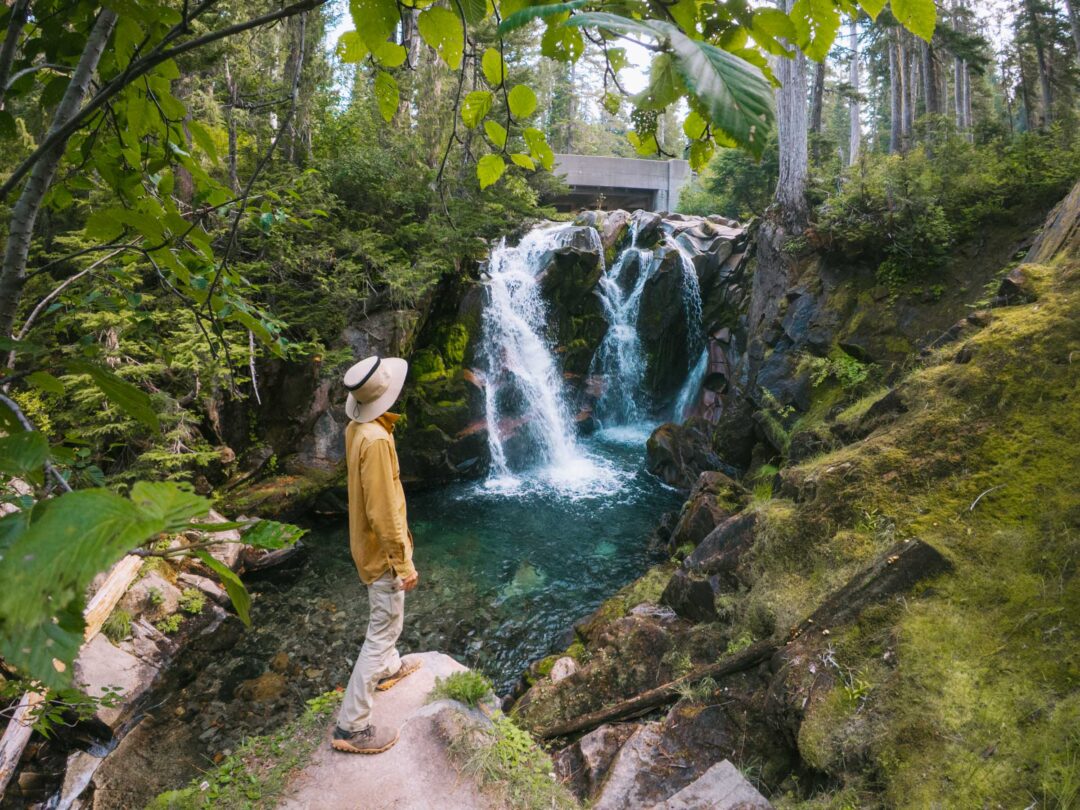
As I made my way into the Carbon River Camp, I crossed Cataract Creek on what might be the most beautiful footbridge in the park. Upstream, a multi-tiered waterfall spilled over mossy rocks, still flowing strongly this late in the season.


I was the last one to get to the camp, which meant that I couldn’t pick what site I wanted. But it’s sometimes nice not to have to make a decision.
Despite the long day, I slept even better than the night before. The trail had worked its magic again.
Our Free Mount Rainier Google Maps Locations
Do you need a handy map with all our Mount Rainier locations? We’ve got a Google Map with all the Mount Rainier locations in this post (plus a LOT more). Sign up in the box below and we’ll deliver it right to your inbox, plus our top tips to help you plan your Mount Rainier adventure.
Day 3: Carbon River to Mystic Lake
For being such a short hiking day, my third day on the Northern Loop turned out to be an eventful one.
I woke up at the crack of dawn, just as first light hit. After having my oatmeal and coffee, I hit the trail, grabbing water from the creek on the way out.
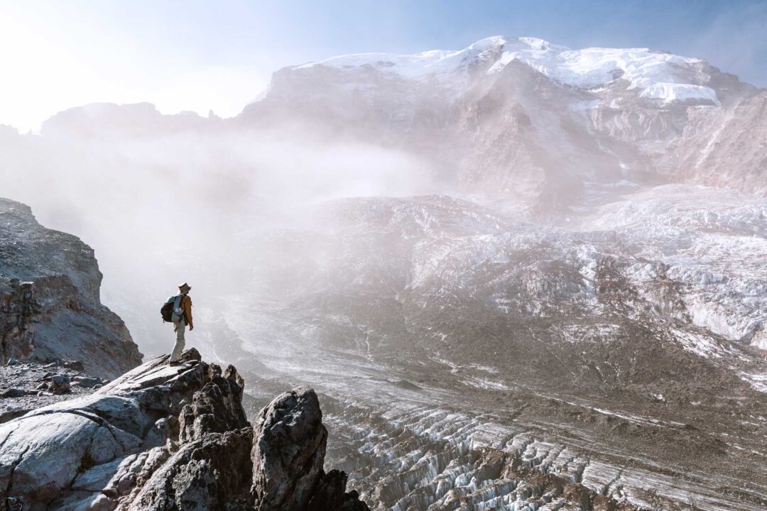
From Carbon Camp, the trail climbed slowly but steadily, hugging the valley wall as it followed the Carbon River. The higher I went, the closer I got to the carbon glacier, and soon I was looking down at it. It was surreal being in a warm area while staring at a massive wall of ice below me.

I soon made it to Dick Creek Camp and stopped there to take a look around. Dick Creek Camp was small, just two small campsites, but one was overlooking the Carbon River valley. Not a bad spot, but a bit tight.
The trail climbed through the forest before opening into a narrow valley. Things started to get less dense around me, and then the trail finally opened up into Moraine Park. It was a massive alpine meadow that looked like prime bear habitat. No bears today, though.


After going through the flat park, the trail turned uphill again and approached a high point – a saddle at the base of Old Desolate. It was still mid-morning at that point, so I decided to go check out the rocky peak.
I found a faint trail going up the side of Old Desolate and followed it for a while. The terrain got steeper, the trail disappeared, and before I knew it, I was scrambling up the side of Old Desolate, picking my way through the scree. What started as curiosity became commitment.

Eventually, I reached a rocky ridgeline that led toward the top… or so I thought. Turned out I had only reached one of its false summits. The true summit was much further out, but I was done. I got what I came for – the view.
And it was epic.
I had a clear, unobstructed view of Mount Rainier’s summit, with the icy Willis Wall feeding the Carbon Glacier below it.
It was a true panoramic view. I could see Mystic Lake, Mineral Mountain, Skyscraper Mountain, the Fremont Lookout, and even the profile of the Burroughs way off in the distance.


The only problem? It was still early afternoon. I wanted to get some sunset photos from this spot, so I still had a ton of time to kill. So I waited it out.
The sun was beating down on me. Nowhere to hide on the summit. I found a nice flat spot to lie down behind a rock, trying to capture every ounce of shade that I could, but it was not enough.
That’s when I remembered that I had all my gear with me. I pulled out my tent, rigged it up with a trekking pole wedged between two boulders, and made a little sun shelter. Perfect. Somehow, I managed to shade the only flat rock on this entire mountain. I laid down and relaxed the afternoon away.


When golden hour finally came, it was time to go to work. I had already scouted my photo spots, so I moved quickly, setting up and shooting before the light disappeared. I think the shots turned out well. But more than anything, I was just glad I made the effort.

Then came the descent.
On the way down, I somehow took a wrong turn and ended up at the edge of a cliff. Good thing I had my GPS tracker on. I retraced my steps. Even small missteps on terrain like that can get hairy fast.
With the sun fading, I made it back to the trail just in time to pull out my headlamp.

My hike to Mystic Camp was in the dark, but the trail was smooth and familiar enough.
I was the last person to get to camp, which normally isn’t a big deal. Except this time, I got stuck with the campsite right next to the creek. It was by far the coldest campsite. I set up camp in the dark, collected water, cooked dinner, and went off to sleep.
Day 4: Mystic Camp to Sunrise
I woke up at 5 AM. A little earlier than usual, but I had a big day ahead of me.
Before heading back to Sunrise and finishing my backpacking trip, I had one last side hike planned. The day before, I’d spotted a faint trail that led out straight toward Mount Rainier.
At the time, I didn’t even know what the trail was called (I later learned that it’s known as the Curtis Ridge Trail,) but either way, it was one of the most epic hikes I’ve ever done.
The trail cut through open meadows before heading up onto a rocky ridgeline and following it up along the side of the Carbon Glacier. It was absolutely mind-blowing to hike straight towards the summit of Mount Rainier.


Below me, the glacier creaked and groaned. In front of me, the massive icy face of the Willis Wall, a seemingly impassable face.
I had a strict turnaround time of 10 a.m. to give myself enough daylight to hike out before dark. All of the glacier’s crevasses were out in full show. But the sounds of the glacier were unexpected. The silence of the mountain was pierced by chunks of ice collapsing and boulders rolling over the glacier’s surface.

By the time I turned around, I was fully satisfied. That side trail alone was worth the trip.
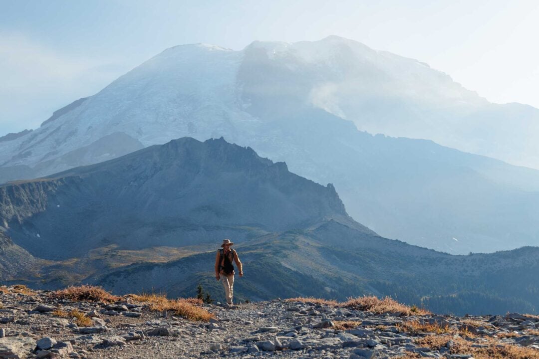
But now it was time to finish what I started. I got back to the Wonderland trail and picked up where I left off. I passed Mystic Lake, finally seeing it in full sunlight for the first time. It was peaceful and still. I stopped for a moment before pushing on.

The trail soon dropped down as it approached the Winthrop Glacier. I was dreading every downhill step because that just meant that I’d have to hike uphill again.


As I hit the exposed section near the base of the glacier, the sun beat down on me. Somehow, it was the hottest part of the entire trip despite being right next to a glacier.

That section past the Winthrop Glacier was an endless uphill slog. I just kept moving, eyes on the trail, waiting for the forest to close in again. When I reached Granite Creek, I finally took a break and cooled down for a few minutes. It was a peaceful spot, but I didn’t linger long.

The final switchbacks brought me through the trees and up toward the cutoff for Skyscraper Mountain. It was the same side trail I took on Day 1. Full circle. I took a second to look back at where I’d been. This was the home stretch.


Hiking into Berkeley Park in the late afternoon felt completely different than it had on Day 1. For one, the wind was gone. Everything was calmer. It was a moment of quiet contemplation of what had transpired over the past few days, and a realization that my trip was coming to an end.

Finally, just as it started to get dark, I made it back to Sunrise. A family of deer wandered out into the open grass, just in time for sunset.
It was the perfect ending to my four-day backpacking journey around Mount Rainier’s Northern Loop. Rugged. Remote. Wild. Exactly what I was looking for.

Our Free Mount Rainier Google Maps Locations
Want a free map of all of the locations mentioned in this post? Sign up in the box below and we’ll deliver one right to your inbox, plus our top tips to help you plan your Mount Rainier trip!
More Hikes in Mount Rainier National Park
We’re based in Seattle and have done a ton of hikes in Mount Rainier National Park. To help fellow adventurers, we’ve put together guides to the best trails we found. You can check them out by clicking the links below.
- Our ultimate Mount Rainier hiking guide: 20 Incredible Hikes in Mount Rainier: Complete Travel Guide
- Hike to a subalpine meadow with views of the Tahoma Glacier: Emerald Ridge Hike
- An old fire watch tower sitting atop a rocky peak: Gobblers Knob
- Rocky peak with an unobstructed view of Mount Rainier: Pinnacle Peak
- Explore the wildflower meadows below Rainier at Summerland, or proceed further to glacial moraines of Panhandle Gap
- Wooden fire watch tower with one of the all time best views in Mount Rainier: Fremont Lookout
- The tallest waterfall in Mount Rainier: Comet Falls
- A short hike that has big views without big crowds: Dege Peak
- 3-night backpacking adventure in Mount Rainier: Northern Loop Trail


I hope you enjoyed my backpacking guide to Mount Rainier’s Northern Loop! feel free to leave a comment below if you have any questions 🐸