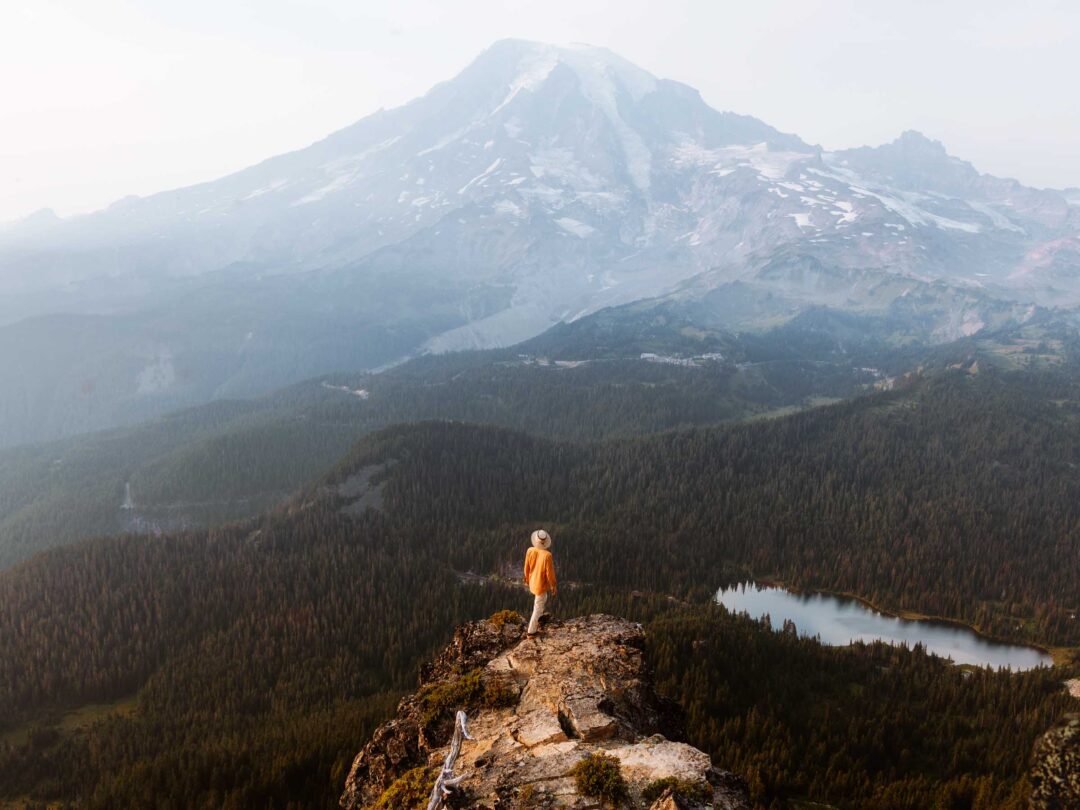
Sometimes the best views of Mount Rainier aren’t from its slopes. Instead, they’re often from the surrounding peaks where you can see the full view of the glacier-covered volcano. That’s exactly what Pinnacle Peak is.
The Pinnacle Peak Trail ascends up to a saddle in the Tatoosh Mountains, with epic views of Mount Rainier. I hiked up the Pinnacle Peak Trail and pushed past the official trail’s end and scrambled to the true summit of Pinnacle Peak. That’s where I caught the mountain glowing during the sunset.
In this guide, I’ll share everything you need to know before hiking to Pinnacle Peak in Mount Rainier National Park, including how to get there, what to expect on the trail, and tips from my own experience to help you make the most of your hike to this rocky panoramic peak in Mount Rainier National Park.


Pinnacle Peak Complete Hiking Guide
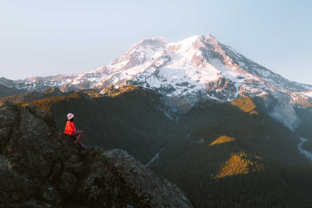
The hike to Pinnacle Peak provides some of the best views of Mount Rainier’s southern face. It’s an incredible hike for sunset as the sun casts a glow across the mountain’s steep glaciers.
The hike begins at Reflection Lakes, one of the most photographed spots in the park. The trailhead sits across the road from the larger of the two lakes. From there, the trail goes off into the forest along a well-maintained trail.

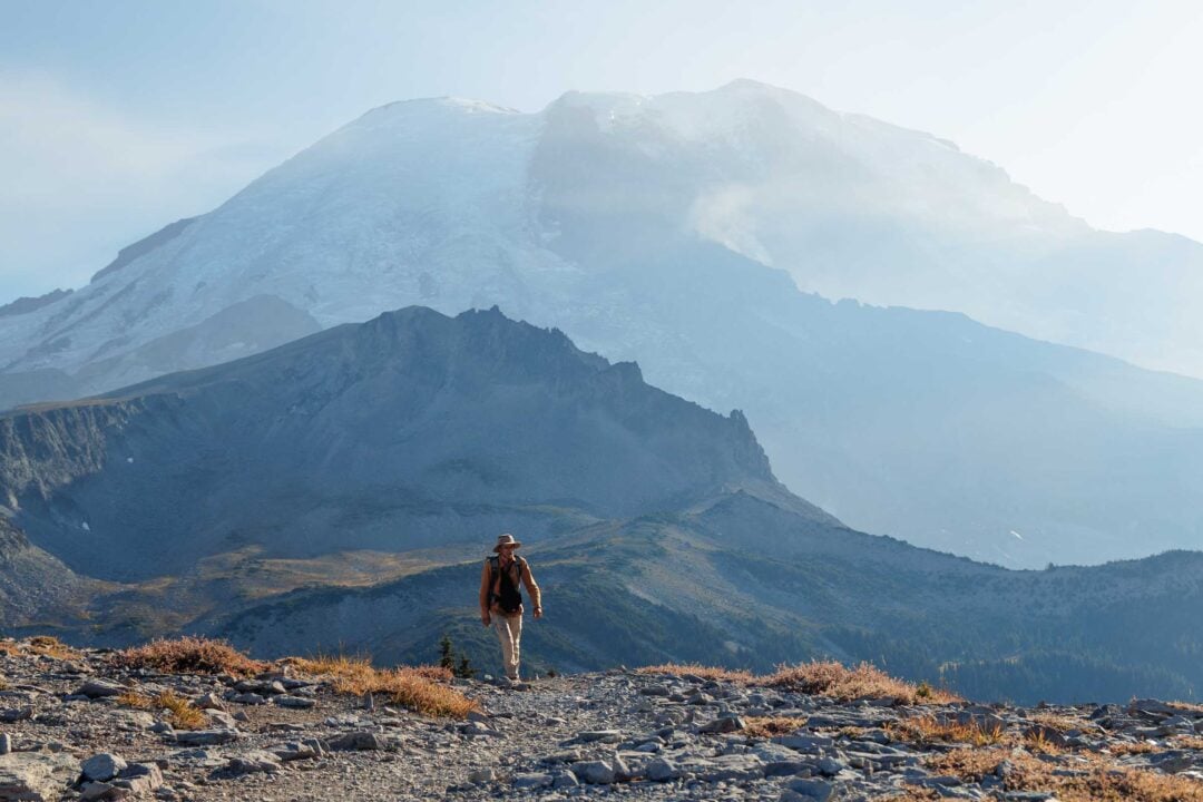
About 0.7 miles in, the trees open up as you step onto the rocky slopes at the base of Pinnacle Peak. The trail gets steeper as it begins to traverse over rocky terrain with jagged Tatoosh peaks rising above you.
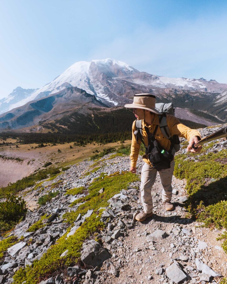
It’s also where Mount Rainier really comes into view. It’s hard not to want to turn around every few steps to catch views of Rainier towering behind you.

After another half mile, the official trail ends at the Pinnacle Saddle, a notch between Pinnacle Peak and Plummer Peak.
From the saddle, you can see through to the other side of the Tatoosh Range, where meadows and hills cascade into the distance, with Mount Adams visible on a clear day.

Scramble to the Pinnacle Peak Summit
The maintained trail ends at the saddle. From there, you can continue up to Pinnacle Peak itself, but it’s important to know what you’re getting into.
The route is unmarked, unmaintained, and consists mostly of loose rock. You’ll essentially be forging your own route, and the terrain quickly turns into a solid Class 3 scramble.

The scramble gets progressively harder the higher you go, with the final push to the summit being the steepest and most difficult. It’s not for everyone, and conditions can change fast.
I can only speak from my own experience and comfort level, so if you choose to attempt the summit, make sure you’re confident in your abilities and willing to turn back if it feels unsafe.

Pinnacle Peak Trail Hike Details
- Hike Distance: The total distance of the hike is about 2.5 miles out and back to the saddle, and about 3 miles out and back if you go all the way to Pinnacle Peak.
- Hike Duration: The hike takes approximately 2 hours in total to the saddle, and possibly much longer if you choose to scramble to the summit.
- Hike Difficulty: The trail’s difficulty is moderate if you only hike to the saddle, but extremely difficult (class 3 scramble) if you hike all the way up to the peak.
- Hike Incline: The hike has an elevation gain of about 1,000 feet to the saddle, and about 600 more feet to the summit of Pinnacle Peak.
- Dogs are NOT allowed on this trail because it is located in Mount Rainier National Park.
- A Mount Rainier Entrance Pass is required to hike to Pinnacle Peak. The trail entrance for the Pinnacle Peak Trail is located in the southern area of Mount Rainier National Park near Paradise. The best way to access this trail is to go through the Nisqually entrance.

How to get to the trailhead for Pinnacle Peak
The trailhead for Pinnacle Peak is located along Stevens Canyon Road, across the street from the Reflection Lakes parking area. It shares the same parking area as people who stop to see Reflection Lakes, so the parking area can get full at times, especially on weekends and holidays.

Pinnacle Peak Hike in Mount Rainier: My Experience
Choosing a sunset hike is always a difficult task for me. I look for a trail that goes to a worthy viewpoint but isn’t so long that I need to hike back in the dark. Pinnacle Peak checked both boxes. So on my first day exploring the Paradise area of Mount Rainier in September, I chose it as my first sunset hike.
The trail started off easy enough. It poked uphill through the woods across the road from Reflection Lakes. I passed plenty of hikers on their way down as they finished their own hikes. It seemed to be a popular hike during the day.
When I emerged from the forest onto the rocky scree-covered landscape, I caught my first sight of Pinnacle Peak. Its jagged ridges towered above me.
The trail then switched back to an incredible view of Mount Rainier, giving the illusion of a perched-out rocky trail looking out toward the summit.


It wasn’t much further to Pinnacle Saddle, where I got my first view of the other side of the mountain range, just beyond the end of the maintained trail sign.
A few other hikers were stopped there, enjoying the view. I took a quick break and made the judgment that I had enough daylight to attempt the scramble to the summit.
Past the saddle, the trail quickly devolved into a mess of rocky scree. There was no clear path in sight.
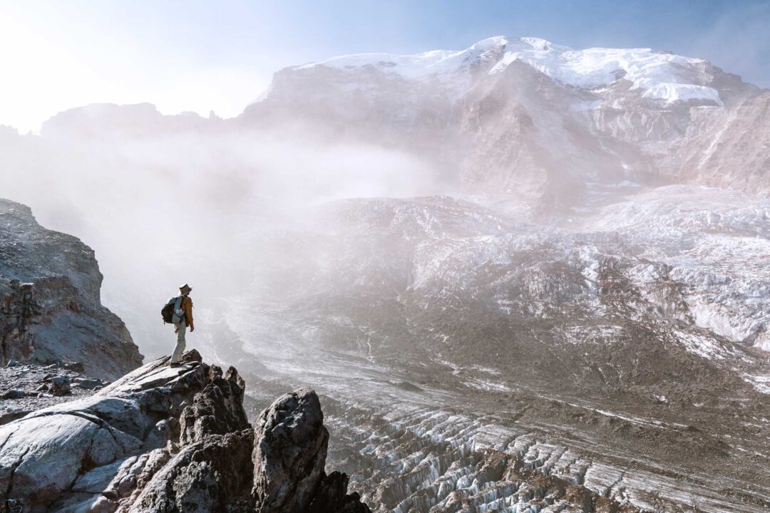
I chose my route carefully, but soon I was scrambling on all fours, using my hands as much as my feet. And it only got harder the higher I climbed. But fortunately, there were plenty of viewpoints along the way.


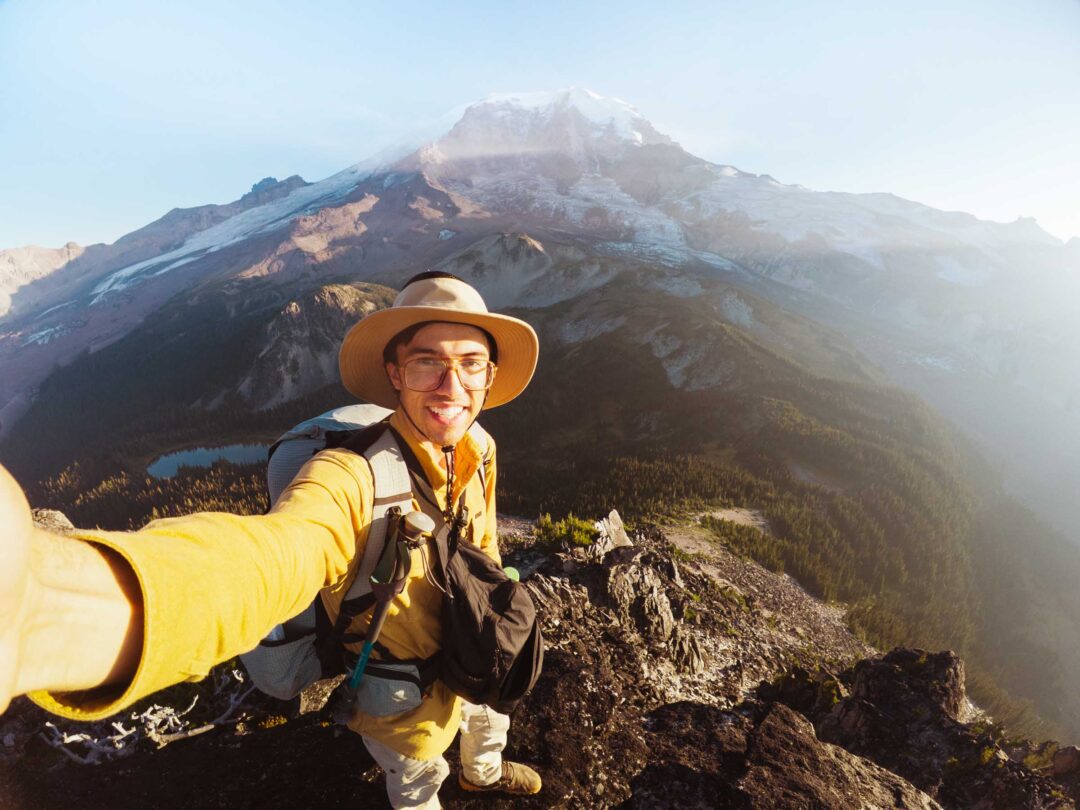
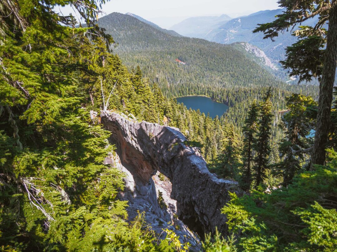
The final push up to the summit of Pinnacle Peak was by far the most challenging. It was a super steep, rocky climb up. Pretty much in rock climbing territory. But once I got to the summit, the views were incredible. Mount Rainier was in the distance, looming through the recent wildfire smoke. The Paradise area and the skyline trail were in full view at the base of the mountain. Views like those always make summits worth it.


I knew I couldn’t linger long as sunset was approaching quickly. I didn’t want to descend in the dark, so I dropped down to a safer ridgeline just below and found a comfortable spot to sit. From there, I enjoyed the final glow of daylight with a snack before packing up and hiking down to end an incredible day.

Pinnacle Peak Trail Photos
To give you an idea of what the trail is like, here are more photos of my hike and scramble to Pinnacle Peak in Mount Rainier National Park.


Our Free Mount Rainier Google Maps Locations
Want a free map of all of the locations mentioned in this post? Sign up in the box below and we’ll deliver one right to your inbox, plus our top tips to help you plan your Mount Rainier trip!
More Hikes in Mount Rainier National Park
We’re based in Seattle and have done a ton of hikes in Mount Rainier National Park. To help fellow adventurers, we’ve put together guides to the best trails we found. You can check them out by clicking the links below.
- Our ultimate Mount Rainier hiking guide: 20 Incredible Hikes in Mount Rainier: Complete Travel Guide
- Hike to a subalpine meadow with views of the Tahoma Glacier: Emerald Ridge Hike
- An old fire watch tower sitting atop a rocky peak: Gobblers Knob
- Rocky peak with an unobstructed view of Mount Rainier: Pinnacle Peak
- Explore the wildflower meadows below Rainier at Summerland, or proceed further to glacial moraines of Panhandle Gap
- Wooden fire watch tower with one of the all time best views in Mount Rainier: Fremont Lookout
- The tallest waterfall in Mount Rainier: Comet Falls
- A short hike that has big views without big crowds: Dege Peak
- 3-night backpacking adventure in Mount Rainier: Northern Loop Trail

I hope you enjoyed my hiking guide to Pinnacle Peak in Mount Rainier National Park. Feel free to leave a comment below if you have any questions 🐸