In the tatoosh range on the south side of Mount Rainier National Park, Pinnacle Peak usually gets all the attention. Most hikers stop at the saddle of the Pinnacle Peak trail to soak in the view, then turn around and head back.
But most people don’t realize that just a short push further lies an overlooked summit: Plummer Peak.
From the top of Plummer Peak, you’ll get panoramic views of the jagged ridgelines of the Tatoosh Mountains on one side, and the massive southern face of Rainier on the other.
And the best part is that reaching Plummer Peak is relatively straightforward. It’s mostly a walk-up, with only a brief simple scramble before you’re standing at the top.
I hiked to the summit of Plummer Peak and put this guide together to help you do the same. Below you’ll find everything you need to know before hiking Plummer Peak, including how to get there, what the trail is like, and what my own experience was like getting up on this rocky summit in Mount Rainier National Park.


Plummer Peak Complete Hiking Guide
Plummer Peak is a 3.2 mile out-and-back hike in the soutern section of Mount Rainier National Park. For being such a short hike with expansive views, i’m surprised its not more popular.
The journey starts at the Pinnacle Peak Trailhead, right across from Reflection Lakes. From there, you’ll follow the well-maintained Pinnacle Peak Trail as it climbs steadily through forest, eventually opening up to the rocky scenery of hte Tatoosh mountains.
The Pinnacle Peak Trail ends at the saddle between Pinnacle Peak and Plummer Peak. It’s the turnaround point where most hikers call it a day.

But instead of stopping at the end of the maintained trail, continue a bit past the saddle while looking for a trail branching off to the right.
This side trail to Plummer Peak isn’t maintained, but it’s easy to follow as it climbs up along rocky slopes.

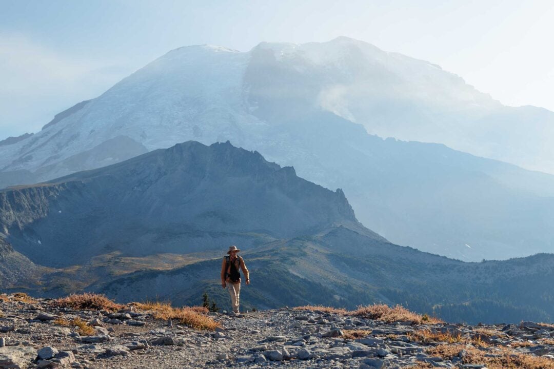
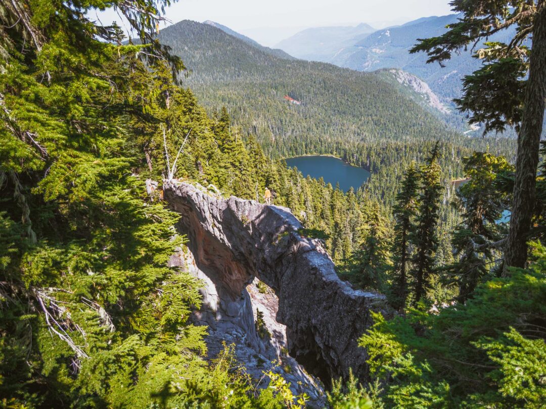
From this point on, the views really start to open up. It’s hard not to stop and marvel at Mount Rainier rising up in the distance and the ridges of the Tatoosh Mountains stretching out around you.
Soon, the trail flattens out into a rocky area with a small seasonal tarn that dries up in the late summer. The trail splits here: one trail continues straight across the flat area toward Denman Peak. But instead, take a sharp left to follow another trail uphill towards Plummer Peak.

From there, the trail gets a little more rugged, but its quite short and manageable for most hikers, especially if you’ve made it this far.
The rocky trail switchbacks upward before finishing with a short scramble. It’s nothing too crazy. But you may need to use your hands for balance as you make your final push to the summit.

At the top of Plummer Peak, find a spot to sit down, catch your breath, and take it all in. The jagged Tatoosh peaks spread out on one side, while Mount Rainier towers in front of you.
And if the weather’s clear, you might even catch glimpses of Mount Adams or Mount St. Helens in the distance. It’s the perfect place to break out a snack and just sit with the views, and even better for sunset.


Plummer Peak Hike Details
- Hike Distance: The total distance of the hike is about 3.2 miles out and back to Plummer Peak.
- Hike Duration: The hike to Plummer Peak takes approximately 3 hours in total to hike out and back.
- Hike Difficulty: The trail’s difficulty is moderate. The trail is in good shape up to the saddle, but then it gets a bit rocky once you make your final push up to Plummer Peak. The final push to the summit of Plummer Peak is an mild class 2 scramble.
- Hike Incline: The hike has an elevation gain of about 1,500 feet to the summit of Plummer Peak.
- Dogs are NOT allowed on this trail because it is located in Mount Rainier National Park.
- A Mount Rainier Entrance Pass is required to hike to Plummer Peak. The trailhead for Plummer Peak is the same as the entrance as the Pinnacle Peak Trail. It is located in the southern area of Mount Rainier National Park near Paradise. The best way to access this trail is to go through the Nisqually entrance.

How to get to the trailhead for Plummer Peak
The trailhead to Plummer Peak is the same that is used to get to Pinnacle Peak. It is named the Pinnacle Peak Trailhead.
The trailhead shares the same parking area as people who stop to see Reflection Lakes, so the parking area can get full at times, especially on weekends and holidays.
The map location below for the trailhead to get to Plummer Peak is accurate and can be used to navigate there.

Plummer Peak Hike in Mount Rainier: My Experience
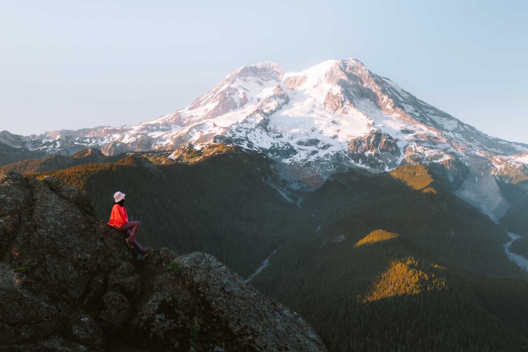
The Tatoosh Range always gets me pumped. Those jagged peaks have such a unique look to them. And one of my most reliable ways to end a day in Mount Rainier National Park is by hiking out there to enjoy the sunset.
As the sun drops in the west, Rainier’s summit lights up at the perfect angle. It always leaves me in awe. But on this day, things played out a bit differently.
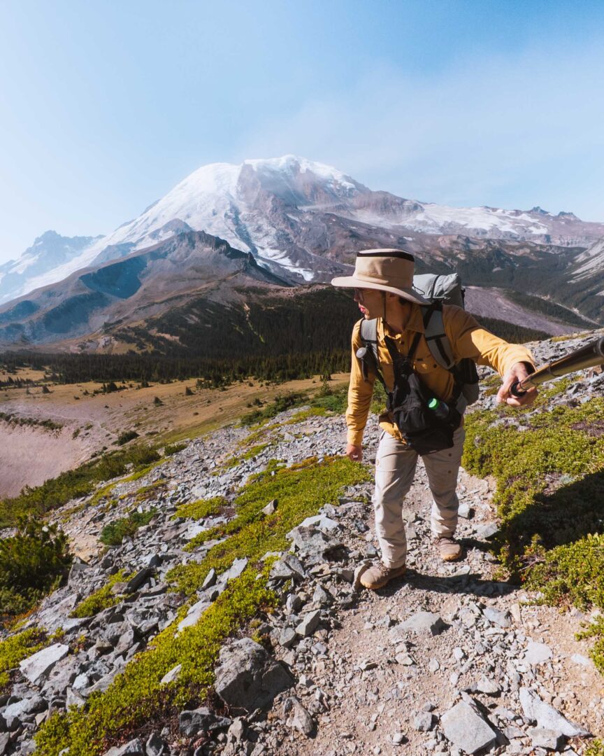
My adventure to Plummer Peak started at the Pinnacle Peak Trailhead, right across from Reflection Lakes. The trail was in great shape, so I hiked up quickly at first as I went through the forest.

But as I approached the saddle and the end of the maintained trail, the weather began changing. Puffy white clouds rolled in, and Rainier’s summit became obscured behind them. Still, I wasn’t about to turn back. I’d come for Plummer Peak, and that’s where I was headed.

I moved through the saddle and found the trail to Plummer Peak. Right away the trail got rockier as it hugged the ridgeline.
When I reached a flat, rocky area, I stopped for a snack and took in the view. The side trail toward Denman Peak was bursting with ripe blueberries. I couldn’t resist snacking my way down the path, and since I still had time, I made a quick detour to Denman Peak before doubling back for Plummer.
Back at the base of Plummer’s summit, it was game on. I followed the trail as it got a little steeper. I took my time and stopped to soak in the views of Rainier, even if it was still cloaked by clouds.
As the rocky path zigzagged upward, I lost the trail a couple of times, but it was easy to find again.

My final push to the summit was where the scrambling finally came into play. A few spots were steep enough for me to use my hands to brace myself as I moved up and onto the summit of Plummer Peak.
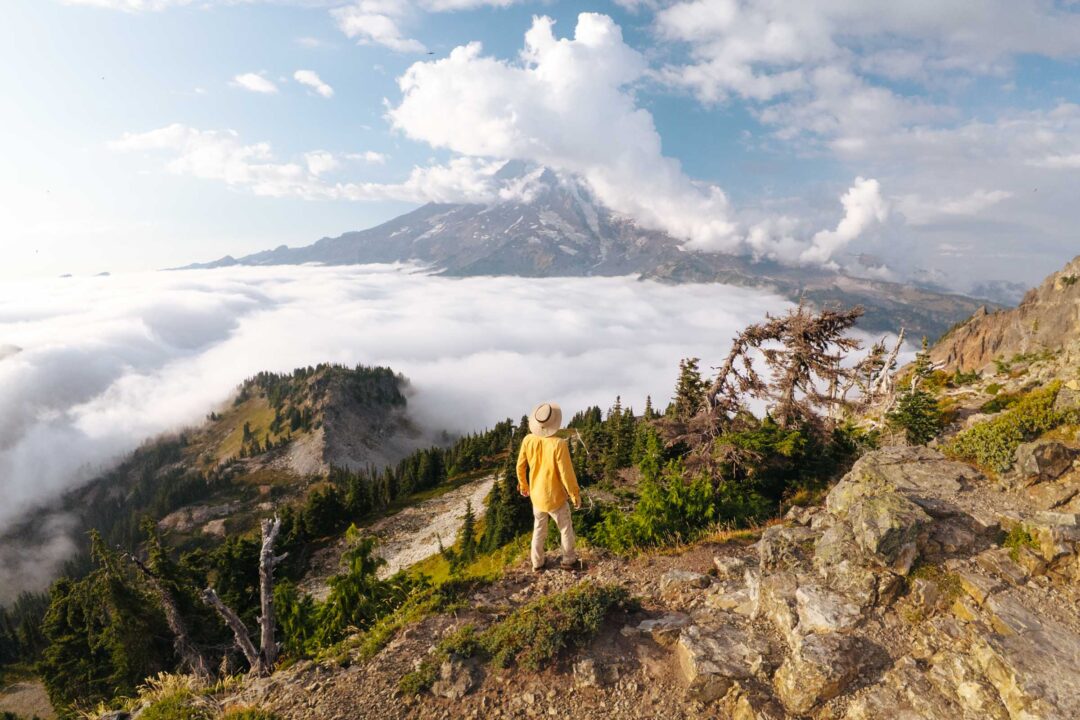
The views from the top were incredible. I looked around at views of the Tatoosh Peaks over on one side, a line of jagged rocky peaks and spotted the faint trail going around the backside of them. And in front of me was mount rainier, still covered in puffy clouds. But that was okay.
Once I sat down for a snack, something incredible began to happen. Low clouds slowly moved in, spilling into the valleys, moving like water trickles over a flat surface.

At one end, the clouds tumbled over a ridge creating a waterfall of clouds. It was surreal. The entire landscape was enveloped in a shifting, glowing sea of white.

I sat there for a while, just watching the show unfold, until the light began to fade. That’s when I realized I’d left my headlamp in the car. Rookie mistake.
With sunset now fully setting in, I had to start down. But as I made my way back toward the saddle, the clouds around Rainier transformed from dull white to fiery reds and oranges. For a few fleeting minutes, the mountain burned with color.

By the time I reached the trailhead, the light was gone, but I didn’t care. It had been one of the most incredible evenings I’ve ever had in the park. It was a reminder that conditions can flip the script, turning an already beautiful hike into something unique and unforgettable.
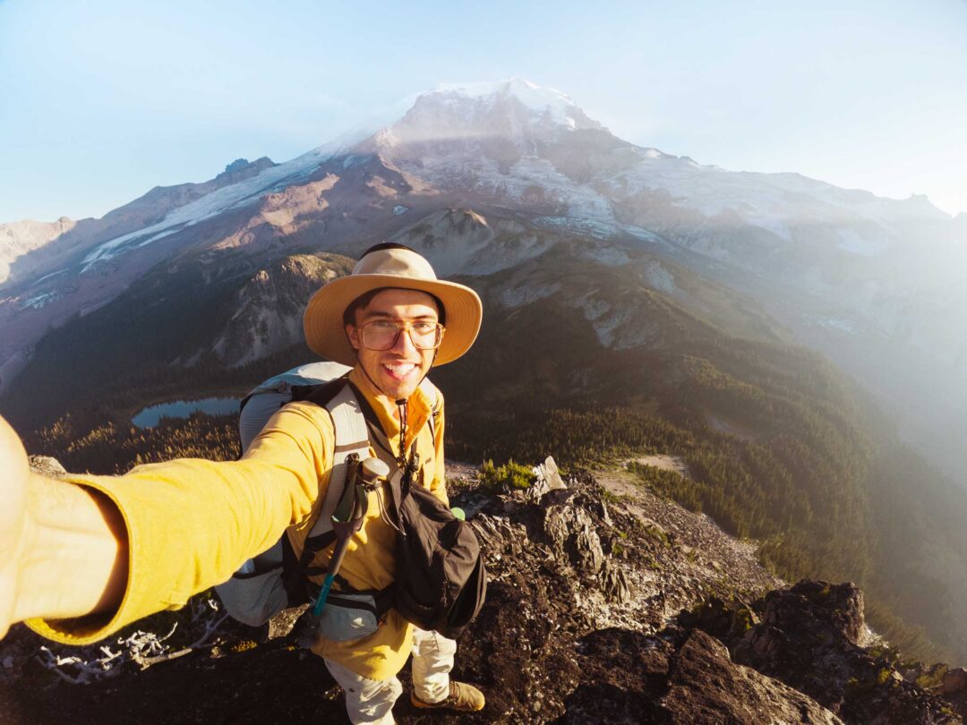
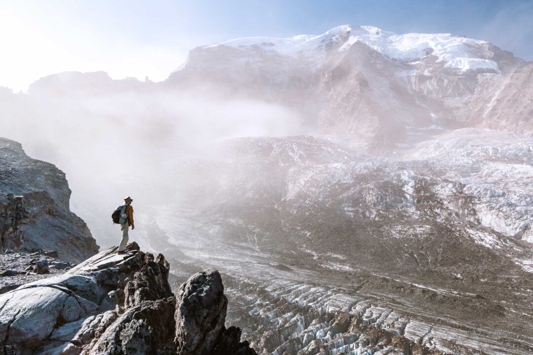
Plummer Peak Trail Photos
Here are a few more photos of my hike to Plummer Peak along the Pinnacle Peak Trail in Mount Rainier National Park. I hope these photos help you get a better idea of what the trail is like.


Our Free Mount Rainier Google Maps Locations
Want a free map of all of the locations mentioned in this post? Sign up in the box below and we’ll deliver one right to your inbox, plus our top tips to help you plan your Mount Rainier trip!
More Hikes in Mount Rainier National Park
We’re based in Seattle and have done a ton of hikes in Mount Rainier National Park. To help fellow adventurers, we’ve put together guides to the best trails we found. You can check them out by clicking the links below.
- Our ultimate Mount Rainier hiking guide: 20 Incredible Hikes in Mount Rainier: Complete Travel Guide
- Hike to a subalpine meadow with views of the Tahoma Glacier: Emerald Ridge Hike
- An old fire watch tower sitting atop a rocky peak: Gobblers Knob
- Rocky peak with an unobstructed view of Mount Rainier: Pinnacle Peak
- Explore the wildflower meadows below Rainier at Summerland, or proceed further to glacial moraines of Panhandle Gap
- Wooden fire watch tower with one of the all time best views in Mount Rainier: Fremont Lookout
- The tallest waterfall in Mount Rainier: Comet Falls
- A short hike that has big views without big crowds: Dege Peak
- 3-night backpacking adventure in Mount Rainier: Northern Loop Trail

I hope you enjoyed my hiking guide to Plummer Peak in Mount Rainier National Park. Feel free to leave a comment below if you have any questions 🐸